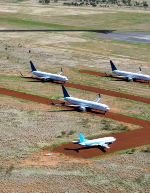
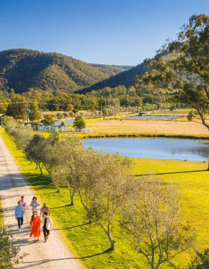
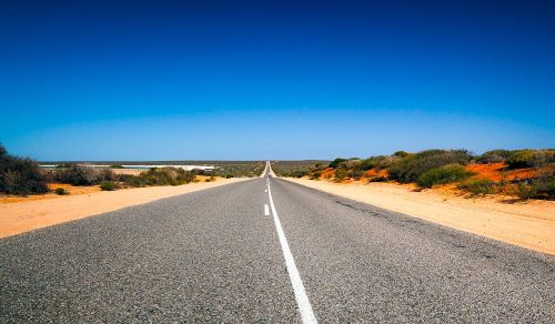
The sheer, wide-open space, the epic views and abundance of wildlife make an outback roadtrip one heck of an experience, but before you set off, you should be aware that this journey is unlike any other drive you have experienced.
The distances between destinations are long, you drive for hours without seeing another person or petrol station (and sometimes even corners in the road). And animals may look cute, but they can be a dangerous, sometimes deadly, obstacle on the road. So here are five tips for outback road safety.
1. Prepare your car for an outback drive or holiday
Even if your car or campervan is a rental, you should make sure you perform some simple vehicle maintenance checks before and during the journey.
• Check your tyres and inflate them to the required level if needed.
• Locate the dipstick and check the oil level.
• Make sure you have a spare tyre with you.
• Check if there is a toolkit.
• Make sure you have a campervan or car user-manual.
2. In the event of a breakdown in the outback…
Don’t try to walk to get help, as you will probably be walking for a very long time in the heat which is dangerous. You might have to wait for a few or even a day for someone to pass by, but it’s the safest thing to do. It’s a good idea to carry a white bed sheet, or anything that can be used to attract attention should you need it.
3. Rules for fuel, food and water when driving in the outback
Plan ahead and stock up on food before you head off. There are remote service stations in the outback where you will be able to buy some provisions, but remember that they may have restricted opening hours and limited ATM facilities. There will also be country motel restaurants and roadhouses if you are in need of a cold drink or hot meal, but be aware that they will cost more than what you would pay in the city.
You should bring enough water – 4 to 5 litres per person, per day. And ensure you carry sufficient food supplies should you break down. Consider stocking up on cereal bars, nut and seeds (avoid salty foods that could accelerate dehydration).
When to fill up? Never underestimate how far away the next petrol station might be – if you are running low, then take a stop and fill up.
4. What road conditions can you expect in the outback?
Road conditions in the outback can change suddenly and you may find yourself suddenly on an unsealed road (gravel track or field). If you have hired a campervan or car from a main city, such as Sydney, Melbourne or Brisbane, then you may find that driving on unsealed roads voids your insurance – leaving you liable for the total cost of any damage.
If you are travelling around Western Australia, you should be aware of the heavy rains and flash flooding that can occur. If you do find yourself at a flooded crossing, do not attempt to drive through if the water if it is too deep or fast flowing – and don’t wade into a fast-flowing river to find out.
5. Watch our for the wildlife in the outback
It’s not uncommon to come across wildlife in the outback; kangaroos, cows and other animals on the roads, particularly at dawn, dusk and at night.
Avoid driving at night, and ask your passenger to stay alert, scan the road ahead and tell you to slow down if they see anything.
Kangaroos have a habit of changing direction suddenly, so if you can’t stop in time, it is sometimes safer to hit the animal than to swerve into oncoming traffic or risk losing control of your vehicle.
Wind through fern tunnels, stop for a wine in a tram bar, or chase giant murals across the wheatbelt. These drives and rides prove Victoria’s best stories are found off the straight and narrow.
There’s something unmistakably Australian about a road trip: car packed, playlist on, landscapes shifting. Travelling down the highway toward Healesville, in Victoria’s Yarra Valley , the mountains rise, flanking me on both sides. I feel its embrace, a silent invitation to explore what lies beyond.
Moss-covered embankments rise on either side, and towering mountain ash trees form a green tunnel overhead. Road signs warn of wombats and cyclists but with giant ferns lining the roadside, the landscape feels prehistoric, as if a dinosaur might suddenly emerge. This, the Black Spur , is one of my favourite road trips.
The Black Spur
Through the forested canopy of The Black Spur drive that winds from Healesville to Narbethong. (Image: Neisha Breen)
The Black Spur is short compared to other Victorian road trips, just 30 kilometres, stretching from Healesville to Narbethong. But what it lacks in distance, it makes up for in scenery. Just outside Healesville, Maroondah Dam offers bushwalks and scenic views. However, if pressed for time, Selover’s Lookout is an easy roadside stop offering uninterrupted views of the dam.
In Narbethong, close to the Marysville’s snowfield, is the Black Spur Inn , a charming double-storey brick hotel that’s been welcoming travellers since 1863. Here, diners cosy up by the roaring fire or gaze through the floor-to-ceiling windows, imagining horse-drawn coaches carrying hopeful gold seekers to the eastern goldfields.
Victoria’s Silo Art Trail
The Silo Art Trail in the Wimmera Mallee region. (Image: Visit Victoria/Anne Morely)
Location: Various towns across the Wimmera Mallee region Duration: More than 200 kilometres / 4–5 hours but best over a minimum of three days
What began as a way to draw travellers back into town bypassed by highways – places such as Nullawil, Sea Lake and Patchewollock – has grown into a celebrated outdoor art movement. The Silo Art Trail now includes 23 silos, each transformed with large-scale mural portraits sharing local stories, celebrating community heroes, Indigenous history, farming life, or regional identity.
The Nullawil silo, for example, is a portrait of a local farmer in a chequered flannelette shirt alongside his loyal kelpie, painted by artist Sam Bates (AKA Smug). And the silos at Albacutya in the Grampians, painted by artist Kitt Bennett, depict her joyful memories of growing up in the countryside. Many of the murals sit right in the heart of small towns, such as Rochester and St Arnaud , making them perfect spots to pause for a country pub meal or something sweet from a local bakery.
Location: Gippsland Duration: Approximately 220 kilometres / 4 hours
The Gippsland Lakes are a much-loved holiday spot in Victoria, but road-tripping further east reveals much more. Begin in Metung and time your visit with the monthly farmers’ market, or simply linger over lunch on the lawn of the Metung Hotel. Twenty minutes away is Lakes Entrance , where you can watch the fishing boats return with their catch.
Continue to Marlo, where the Snowy River spills into the sea, and Cape Conran for its many beaches and walks. If needing to stretch your legs, Croajingolong National Park is home to the historic Point Hicks Lighthouse and the Wilderness Coast Walk. Birdwatching and rainforest trails near Bemm River are worth a pit stop before arriving in Mallacoota, where the forest meets the sea.
Great Ocean Road
The 12 Apostles on the Great Ocean Road. (Image: Tourism Australia/Two Palms/Harry Pope)
Location: South-west Victoria, from Torquay to Allansford Duration: Approximately 250 kilometres / 4–5 hours but best over a minimum of three days
Victoria’s most famous road trip delivers it all: world-class surf breaks, rainforest walks, clifftop lookouts and wildlife encounters. The journey begins in Torquay, the state’s surf capital, then hugs the coast past Anglesea and Lorne to Apollo Bay, before curving inland through the lush rainforest of the Otways. Stop at Cape Otway Lightstation or take to the treetops at Otway Fly.
Between Cape Otway and Port Campbell lies the most photographed stretch – seven of the Twelve Apostles still standing, alongside the golden cliffs of Loch Ard Gorge. Further west, Warrnambool is a winter whale-watching hotspot, before the road winds to Port Fairy, a charming fishing village of whalers’ cottages, walking trails and offshore seal colonies further along the coast.
Location: Bellarine Peninsula Duration: Approximately 80 kilometres / 2–3 hours
The Bellarine Taste Trail is a feast for the senses, winding through coastal towns, past boutique wineries and artisan producers. It’s a choose-your-own-adventure style trail – simply grab a map and build your own delicious journey.
You might wander historic, seafront Queenscliff, sip wine in a converted tram bar at Terindah Estate , sample a locally distilled whisky at The Whiskery in Drydale or pick up a jar of honey at Wattle Grove in Wallington. Seafood lovers can head to Portarlington, famous for its mussels. Eat them fresh at local restaurants or head out on the water with Portarlington Mussel Tours.
O’Keefe Rail Trail – Bendigo to Heathcote
Pink Cliffs Reserve in Heathcote can be seen on the O’Keefe Rail Trail. (Image: Visit Victoria/Emily Godfrey)
Location: Central Victoria Duration: Approximately 50 kilometres / 4 hours cycling
Travellers first journeyed between Heathcote and Bendigo in 1888, when the railway line was built to link the towns. Trains stopped running in 1956, but today the route has a new life as the O’Keefe Rail Trail . The path is mostly level for easy riding, and along the way you’ll cycle past bushland, waterways and reserves. There are plenty of places to picnic, birdwatch, and if you’re lucky, spot a platypus.
The trail is well supported with water stations, bike repair points, shelters, and signage. Axedale makes a great halfway stop, with the pretty Campaspe River Reserve for a rest and local cafes for refuelling. Begin in Heathcote, known for its wineries and cafes, or in Bendigo, which is easily reached by train from Melbourne/Naarm. Shorter sections, such as Heathcote to Axedale, are also popular.
Goldfields Track – Ballarat to Bendigo
Location: Central Victoria Duration: Approximately 210 kilometres / 2–3 days cycling
The Goldfields Track traces a route once so rich in gold it made Melbourne one of the wealthiest cities in the world. Starting at Mt Buninyong, south of Ballarat, the trail leads mountain cyclists and walkers north through Creswick, Daylesford and Castlemaine before finishing in Bendigo. Along the way, you’ll encounter granite outcrops, eucalypt forests, rolling farmland and remnants of the region’s mining past.
As it passes through the lands of the Dja Dja Wurrung and Wadawurrung people, the track shares gold rush history and Indigenous stories brought to life by interpretive signs. Walk or ride the full trail or choose from one of its three distinct sections. With cosy stays, cafes and pubs, it’s easy to mix wilderness with comfort.