Discover the region’s boundless beauty at your own pace with the most captivating walks and hikes in Port Macquarie.
Beaches, wildlife, rainforest and spectacular coastline – everything shifts into vivid focus on any well-positioned NSW North Coast hiking route. But when it comes to the expansive, picturesque beauty of the Hastings Region, Port Macquarie and its surrounds are the ultimate place to be. Here, find all you need to know about the best walks and hikes in Port Macquarie and nearby.
Easy hikes in Port Macquarie
Looking for an easy hike in Port Macquarie? These trails are relatively smooth, with very few obstacles or elevation gains, and are suitable for people of all ages and fitness levels. Some even feature wheelchair access.
1. Kooloonbung Creek Walks — Kooloonbung Creek Nature Park
Time from Port Macquarie centre: 3 minutes
Its prime location and ease of accessibility make Kooloonbung Creek Nature Park’s two individual walks worthy of exploration by people of all abilities and fitness levels.
Koalas, sugar gliders, lizards, flying foxes and over 165 known bird species have been sighted within the park, providing ample opportunity for animal-spotting along the way. There is also a historic cemetery that dates to 1821, home to the graves of notable early colonisers. The Cath Le Page Arboretum, or the Garden of Trees, also contains several native trees that are endemic to the area.
Choose Circuit 1 or Circuit 2. The former clocks in at 2.3 kilometres and takes about 45 minutes to complete. It contains some steps, so prams and wheelchairs are unfortunately too tricky to navigate. The latter is a 1.3-kilometre trail that takes about 25 minutes to do and, again, is not suitable for wheeled transportation.
Distance: Either 2.3 kilometres or 1.3 kilometres — or combine them for one epic trek.
Getting there: The park boasts ten access points with two located off Circuit 1 on Gordon St, right in the centre of town.
Accessibility: None
Facilities: Circuit 1 features two sheltered picnic tables (there aren’t any along Circuit 2) and there are toilets and an information board near the cemetery off Gordon St.
2. Sea Acres Rainforest Boardwalk
Time from Port Macquarie centre: 10 minutes
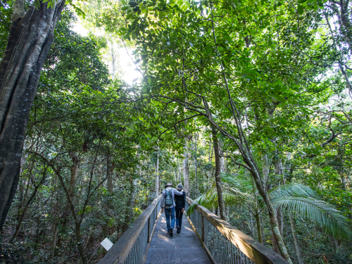
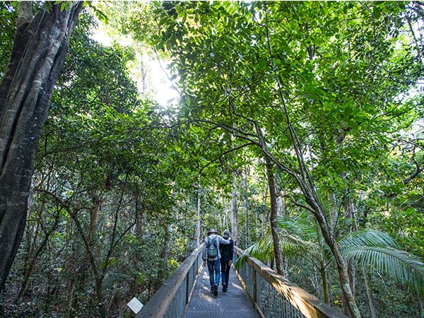
This walk in Port Macquarie, located within Sea Acres National Park, will guide you to a rainforest canopy, rising seven metres above the forest understorey to help you marvel at the magic from above. The boardwalk platform begins at the Sea Acres Rainforest Centre where you can mentally prepare to encounter rainforest birds, goannas and the mostly harmless diamond python.
Take the time to read educational resources that shine a light on the park’s threatened resident species, signposted along the way, as well as the significance of this habitat to the Indigenous Biripai people. The original custodians used the walking stick palm as a travel aid and made weapons from the python tree, which is the second hardest wood in the world.
Distance: 1.3 kilometres
Getting there: From the centre of town, head south on Pacific Drive until you hit Sea Acres Rainforest Centre at the entry to Sea Acres National Park just after Shelly Beach Rd.
Accessibility: Yes, as the trail is mostly flat and there are no steps. Two accessible car parks at the entry, plus an accessible toilet at the Sea Acres Rainforest Centre.
Facilities: The Sea Acres Rainforest Centre has toilets and there are five bench seats dotted along the walk.
3. Grants Beach Coastal Walk
Time from Port Macquarie centre: 25 minutes
Eucalyptus, paperbark and banksia woodlands offer plenty for nature lovers to marvel at along the Grants Beach Coastal Walk, particularly in late winter and early spring when native flowers are in bloom. The glorious stretch begins at North Haven alongside the Camden River, passes by Grants Beach and ends at Grants Headland in Bonny Hills.
This popular trail is also a great way to kick off your hiking adventures in Port Macquarie as it’s considered an entry-level option. Ensure you take lots of water, as there are no shops or amenities along the route.
Distance: 7.4 kilometres return
Getting there: Head out of Port Macquarie and drive south to North Haven. The entrance is located on The Parade, near the mouth of the Camden Haven River.
Accessibility: None — the trail is sandy at many parts.
Facilities: None
Need tips, more detail or itinerary ideas tailored to you? Ask AT.
AI Prompt
4. Old Bottlebutt Walking Track
Time from Port Macquarie centre: 30 minutes
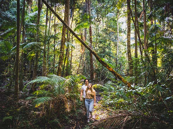
Old Bottlebutt is a Port Macquarie legend found within the Boorganna Nature Reserve. The incredible tree is the largest Red Bloodwood in the Southern Hemisphere and the family-friendly Old Bottlebutt Walking Track will escort you right to it.
This walk will take you through rainforest, creek crossings and footbridges to meet the 200-year-old beauty. Once you arrive at the viewing area, marvel at the magic of one of the most unique towering wonders in the country.
Distance: 600m loop
Getting there: Punch Wauchope into your Maps and when you get there, travel south on Bago. Rd another 10 kilometres before turning left onto Internal Break Road and following the signs.
Accessibility: Yes, it caters for visitors with access needs including wheelchairs.
Facilities: None, but the trail starts at the Burrawan Picnic Area which has toilets and picnic tables.
Moderate hikes in Port Macquarie
If you’re keen for a more challenging walk and hike in Port Macquarie, these picks feature steeper climbs and obstacles to be navigated with caution. Some parts may be wheelchair accessible, but most will have limited accessibility considering the elevation gains. They are suitable for people with intermediate fitness levels.
5. Port Macquarie Coastal Walk
Time from Port Macquarie centre: 5 minutes
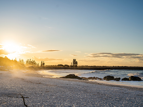
This Port Macquarie Coastal Walk, set within Sea Acres National Park, is as iconic as the town itself with its breathtaking coastal scenery and spectacular views. You’ll be in good company, with friendly locals, cyclists, skaters, walkers and runners all flocking to the coastal walk daily.
Commit to the entirety, which typically takes about three to four hours to complete (pushing this walk’s grading up from easy to moderate) or tackle one of its four sections: Westport to Town Beach (2 kilometres), Town Beach to Flynns Beach (2.2 kilometres), Flynns Beach to Shelly Beach (2.2 kilometres) and Shelly Beach to Tacking Point (2.7 kilometres).
Many opt to join the track just outside The Westport Club, and weave nine kilometres to the south along the Hastings River and the iconic Breakwall, hugging the coastline all the way to Tacking Point Lighthouse. There are plenty of spots to stop along the way, providing food, coffee and entertainment to match the views.
Distance: 9 kilometres one-way, but you can split the walk up into sections (outlined above).
Getting there: Kick your expedition off at Westport Park on Park St in Port Macquarie’s town centre.
Accessibility: None, as there are regular steps, steep sections and some obstacles
Facilities: Picnic areas, accommodation and shops can be found along the way so check out a map of the entire stretch to know what’s where.
6. Diamond Head Loop Walk
Time from Port Macquarie centre: 50 minutes
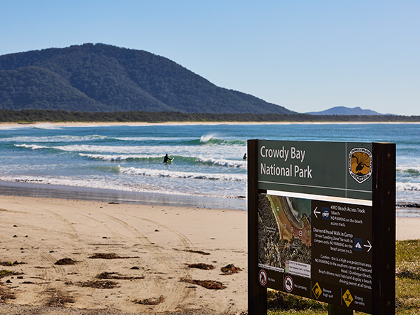
Introduce yourself to the exceptional beauty of Crowdy Bay National Park by way of the Diamond Head Loop Walk. The trail links through the forest on a moderately difficult hike packed with highlights. Marvel at the swathes of forest and foliage as well as the quartz crystals in the cliffs, which often sparkle in the sunlight on a bright day.
Kylie’s Lookout is a great place to stop and enjoy the view. It’s famed for delivering some of the best dolphin and whale sightings from land. Meanwhile, the headland provides panoramic views out to Crowdy Bay, north towards Perpendicular Point and south towards Crowdy Head.
Distance: 4.3-kilometre loop
Getting there: You’ll find its entry via Diamond Head Rd — go through the Diamond Head campground in Crowdy Bay National Park.
Accessibility: None
Facilities: None but there are toilets and picnic tables at the Diamond Head campground where the walk begins.
Weekly travel news, experiences
insider tips, offers, and more.
Hard hikes in Port Macquarie
The toughest hikes in Port Macquarie are moderate to arduous paths, which may feature treacherous areas and steep climbs. They are only appropriate for experienced bushwalkers and hikers and not suitable for people without a sufficient level of fitness.
7. Laurieton Track
Time from Port Macquarie centre: 40 minutes
The Laurieton Track in Dooragan National Park is reserved for the most intrepid of nature lovers. This rousing walk in Port Macquarie takes you atop the picturesque summit, where views rank among the best in the state.
Part of the Three Brothers Track, this easily accessible route will weave you through eucalyptus and blackbutt trees amid an abundance of wildlife. While we recommend this walk for anyone with an affinity for the great outdoors, there are long, winding and steep sections that may be too challenging for beginners.
Distance: 3 kilometres one-way
Getting there: Walk through the council park on Laurie St to find the trail behind some houses. There is very limited signage throughout the entire trail, FYI.
Accessibility: None
Facilities: None
8. Rawson Falls Walk
Time from Port Macquarie centre: 1hr
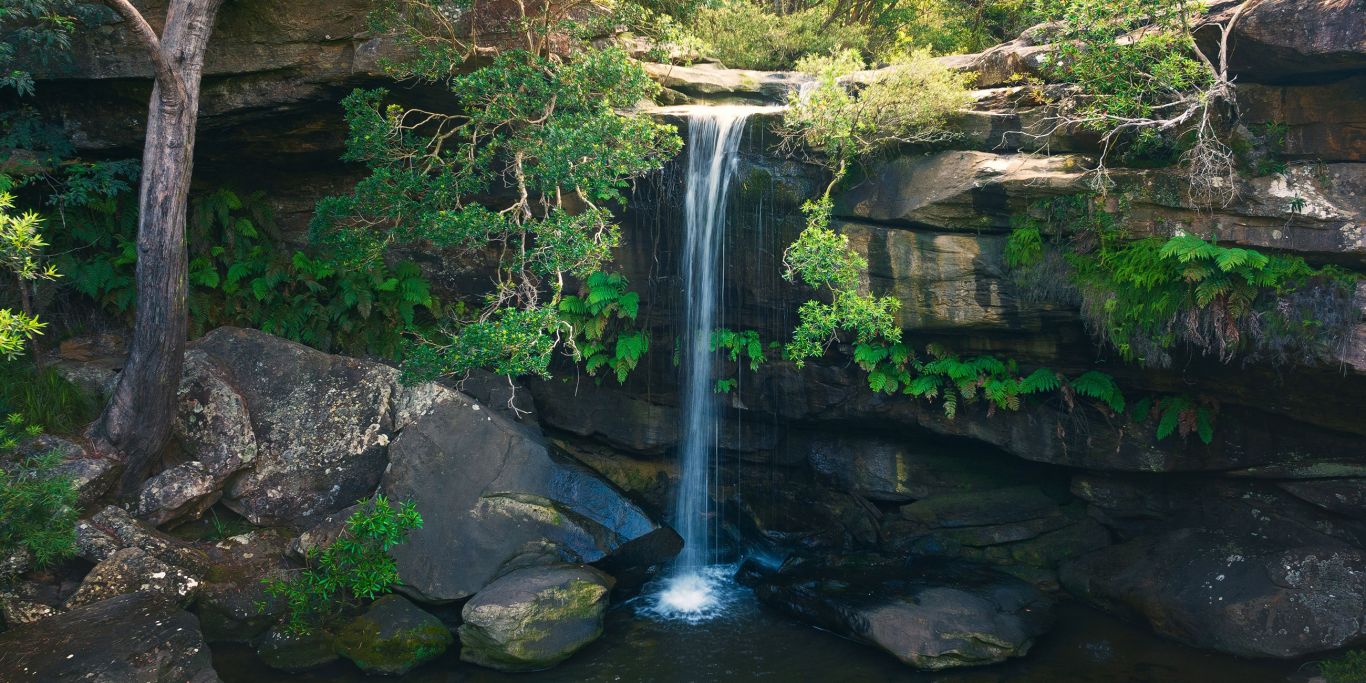
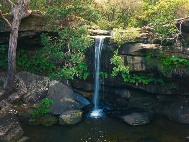
Many make the mistake of visiting the Boorganna Nature Reserve without doing the Rawson Falls Walk – don’t be that person. Instead, make the 2.5km journey down to the very bottom of the waterfall, stopping to take a dip in the deep, tranquil plunge pool at its base.
For those who don’t feel like a swim, there is a viewing platform that shortens the distance to about 3.4 kilometres return. Take in the sights and sounds of varied flora and fauna, encompassed by the 40-metre-tall trees around you. Spring brings flowering orange blossoms and cinnamon orchards, which can be marvelled at while you eat a packed lunch by the picnic area.
Distance: 5 kilometres return
Getting there: Hit Main St, north of Comboyne, and stay on it as it turns into Wingham Rd. Chuck a right onto Innes View Rd to follow signs to the Boorganna picnic area where this trail begins.
Accessibility: None
Facilities: There’s a picnic area at the waterfall, and educational signposts dot the trail.
Originally written by Eliza Sholly with updates by Kristie Lau-Adams.
Want to see more stories from Australian Traveller in your Google search results?
- Click here to set Australian Traveller as a preferred source.
- Tick the box next to "Australian Traveller". That's it.