
Forget the beachside crowds and make a splash along the river instead.
Summer has only just begun and Sydney’s already scored a new spot to cool off. The sandy riverside stretch is offering locals a quiet escape from the heat and hints towards a city slowly reclaiming its waterways.
Where is Sydney’s new beach?
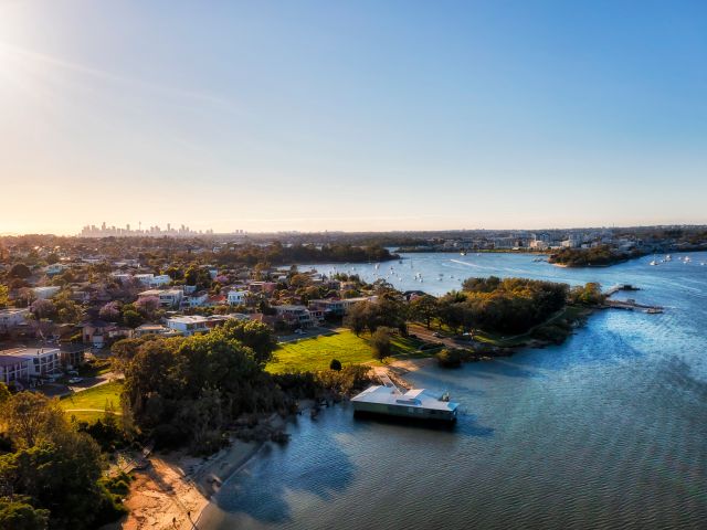
Nestled along the Parramatta River roughly 15 kilometres from Sydney’s CBD, the waterfront suburb of Gladesville has gained a new swimming spot just in time for summer. Although new may not be the most accurate way to describe it.
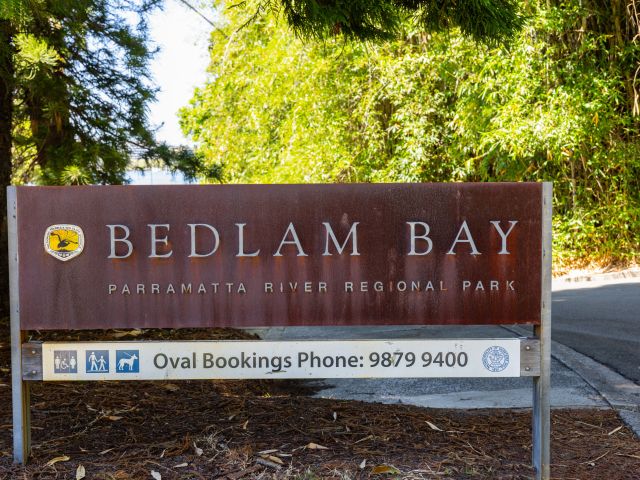
Originally opened to the public back in the 1860s, Bedlam Bay has long been a treasured outdoor space for the local community. But the bathing site was demolished in 1956 due to the development of a sports oval and increased water pollution. Now, after almost 70 years, swimmers are being welcomed back.
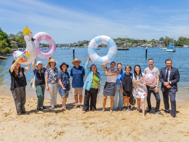
Hunters Hill mayor Zac Miles says reactivating the site provides a valuable community asset this summer. “This project highlights our ongoing commitment to enhancing community recreation around our natural waterways. It’s great to reactivate this cherished place once again for our community and visitors alike to enjoy."
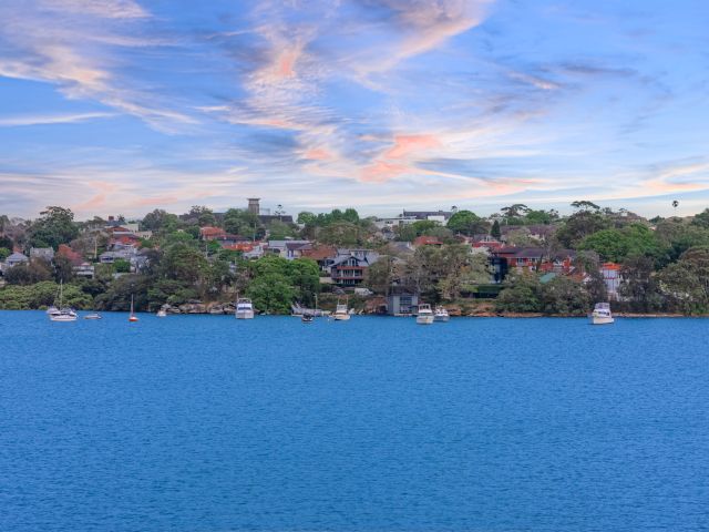
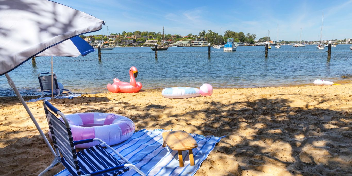
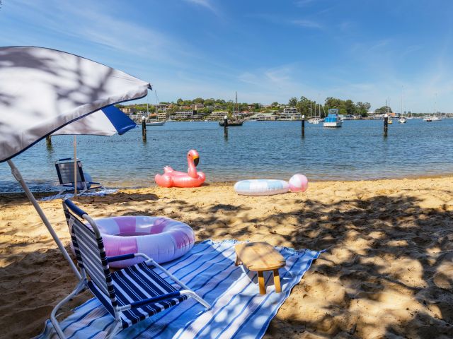
Nestled at the bottom of Parramatta River Regional Park, the swimming spot looks out towards bobbing moored boats and is surrounded by greenery. It’s a low traffic area with plenty of peaceful pockets to enjoy the sun – minus the crashing waves, crowded shores and often long-winded drives to other popular beaches in Sydney.
Need tips, more detail or itinerary ideas tailored to you? Ask AT.
AI Prompt
Is it safe to swim at Bedlam Bay?
In recent years, local councils and the NSW government have been committed to improving the water quality of the Parramatta River. Working with Sydney Water and the Parramatta River Catchment Group , over $560,000 worth of funding has been invested into making Bedlam Bay suitable for swimmers again.
Upon opening, the site features a secure shark net to keep visitors safe, as well as on-site lifebuoys and a boat jetty. It adds to a growing line-up of seven revitalised swimming spots along the waterway, including the establishment of Putney Beach back in January.
Thanks to programs like RiverWatch™, water quality at the site has been continuously monitored since 2020 to ensure it is safe for aquatic activities.
The Sydney Water initiative assesses microbial contaminants such as algae, enterococci and chlorophyll-a in water samples, as well as temperature, turbidity (the amount of material suspended in the water) and conductivity (an indicator of salts in the water).
Even once a site is marked safe, levels are continuously monitored during its ongoing operation. Routine sampling occurs every four to six days, as well as five days of consecutive targeted sampling at sites that have received heavy rainfall.
“Our RiverWatch™ recreational water quality monitoring program was specifically established to support the opening of new swim sites in waterways," says Leanne Niblock, waterway coordination manager of Sydney Water.
“Sydney Water has also made a significant investment in upgrading the wastewater network in the upper and mid Parramatta River catchments to reduce the impact of wet weather overflows, directly supporting the swimming outcome in the Parramatta River."
Weekly travel news, experiences
insider tips, offers, and more.
How do I get to Bedlam Bay?
If you’re driving, it’ll take you roughly 15 minutes to get to Bedlam Bay from Sydney’s CBD via the Anzac Bridge, or Victoria Road from the city’s northern and western suburbs. Parking is available at Gladesville Hospital, just a 10-minute walk away, but fees may apply.
There are also plenty of public transport options . Sydney’s F3 ferry service from Circular Quay will take you to Huntleys Point Wharf, two kilometres away. This route also stops at all major ferry terminals along the Parramatta River. The 501, 507 and 536 bus routes all stop at Gladesville Hospital, too.
Like many of Australia’s natural swimming holes, locals heading to Bedlam Bay can dive in with confidence knowing that they’ll be swimming safely this summer. Stay up to date with water quality alerts via Urban Plunge by Sydney Water or the Parramatta River Catchment Group’s interactive map .