What it’s like to road trip from Alice Springs to Port Fairy

hero media
Robyn Rosenfeldt embarks on an odyssey from the middle to the edge, from Alice Springs to Port Fairy, and watches the Australian landscape change with each turn of the wheel.

I look around. There’s not a tree in sight. The summer sun is belting down hard on the red earth. From this vantage point I can see no water, no shelter and for that matter no life. And I’m going to spend the next nine days driving through this. What on earth am I thinking?
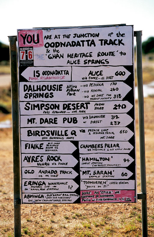
Crude but effective, this is the signpost that greets you at the beginning of the Oodnadatta Track. Image by Robyn Rosenfeldt

All of this is observed from the comfort of my airline seat as I fly from Melbourne to Alice Springs. In two days’ time I’ll drive out from Alice with three friends, on a journey that will take us clear across the country. South from Australia’s hot, dry centre, along the Old Ghan Railway Heritage Trail, the Oodnadatta Track, through The Northern Flinders Ranges, down into NSW to Lake Mungo National Park, on to Mildura and then across Victoria to our final destination – the sparkling coast at Port Fairy.
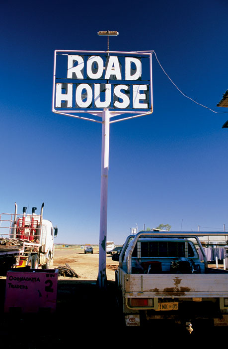
The Oodnatta Roadhouse. Image by Robyn Rosenfeldt

Trailing the Old Ghan

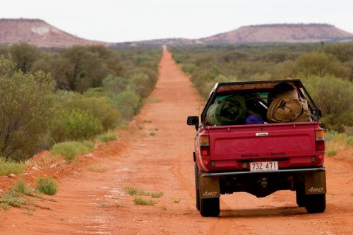
As we drive south through The Gap, the point at which the Todd River cuts through the MacDonnell Ranges and which marks the outskirts of Alice Springs, we’re all excited to be on the road. Our big red Toyota is packed with swags, food, guitar, eskies, beer and – most importantly – spare diesel and water.
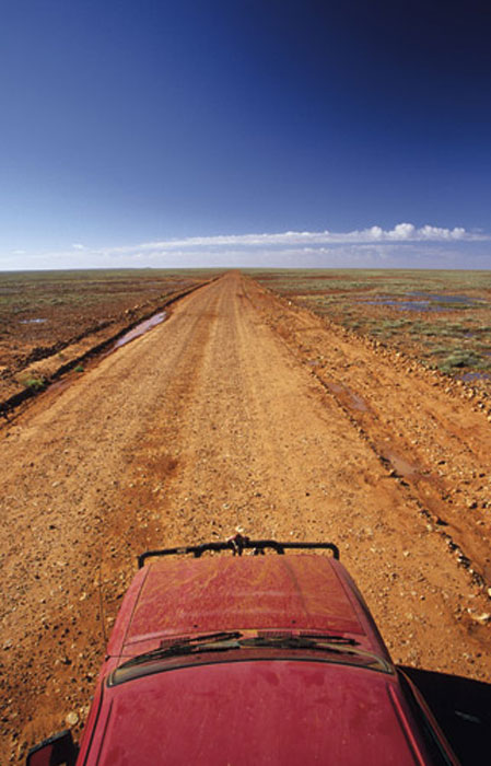
Driving through the flat expanse on the Old Ghan Heritage Trail. Image by Robyn Rosenfeldt

We turn off the Stuart Highway down the Old South Road and, as the wheels spin on the red earth, our adventure begins. The first part of our journey will follow the Old Ghan Railway Line that was abandoned when it was replaced with the current Ghan Line, which runs further west. Named after the afghan traders that rode their camels through these parts, the railway follows the old telegraph line, the construction of which was the impetus for Burke and Wills’ fateful journey.We head south along the dirt red track, past Mt Ooraminna, which we climb before stopping at Bundooma, an old railway siding, for lunch. We’ve barely gone 50km on our journey when we’re almost stopped altogether by swollen rivers crossing the road. Just south of Finke, we come across a creek that has burst its banks and is flowing quickly and deeply across our path. And here I thought this was supposed to be the desert.


To be completely safe, we decide to wade through the river before driving, to check the depth and strength of the current. With water thigh high and almost fast enough to knock us over, we’re a little nervous about driving into it. But we realise there’s no going back, so we give it a go; our big red truck forges a path like Moses through the Red Sea.


We cross four more swollen creek beds, none quite so deep or fast-flowing, and come out the other end just as the sun is setting, turning the surrounding countryside a fiery radiant red. After stopping to collect firewood and admire the scenery, we find our camp for the night, a glade of red mulga trees by a dry creek bed. Kicking back on our rolled up swags, cool beers in hand, we cook and eat dinner beneath the stars. After a few songs around the campfire we roll out our swags. As I lie watching the stars twinkle through the mulgas, with the breeze blowing across the desert plains, I feel high on life. This is the way to live, out in the elements, in touch with nature.


After a quick stop in the morning at the Mt Dare Hotel we drag our swags beneath the shady palms and have lunch, followed by a siesta. Taking our time, we follow the track on to the Oodnadatta through Fogarty’s clay pan, just in time to have a beer at the Oodnadatta pub and find a spot to camp on the clay pans on the outskirts of town. to fill up on fuel and water, we head out to Dalhousie Springs, where water temperatures reach 43 degrees. Just near the springs the old telegraph station buildings stand in varying states of disrepair, beside a mound spring oasis.

Need tips, more detail or itinerary ideas tailored to you? Ask AT.

AI Prompt

Stranded at Lake Eyre…

The salt on the surface of Lake Eyre forms a dry crust, under which lies soft brown sludge. We’re fully aware of this as we drive out on to it, watching the tyres to make sure the earth beneath us is still holding firm. But, like many adventurers, we creep out too far and . . . squelch. We’re stuck. The wheels are spinning and the car’s not moving.Now, just to paint a clear picture of our situation: we haven’t seen another car all day, we have no means of communication and we’re a long way from help. Things are looking dire, so we get the lightest member of our team to jump in the driver’s seat, the boys roll up their sleeves and start pushing, leaving me to do what seems most appropriate in this sort of situation: start taking photos. That is until I’m yelled at. I join in the pushing, eventually the tyres find traction, she rolls on the tracks we came in on and – aaah – sweet, solid ground. That was a little too close.
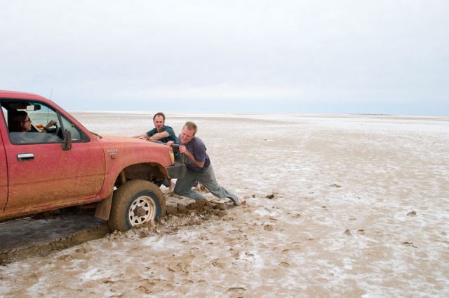
A close escape on Lake Eyre. Image by Robyn Rosenfeldt

Walking out on to Lake Eyre is like traversing a moonscape. The endless expanse of white stretches out all around you. With an overcast overhead, it’s difficult to see where the sky ends and salt begins. We walk out until all we can see is white in all directions. We’re unsure of where to camp tonight as the surrounding country is vast and vacuous and offers no shelter. Just out of Marree we find a small rise that offers a few ragged saltbushes, so we camp behind them to take shelter form the desert winds.

Flinders Keepers

Leaving Marree and “the Ood" (as we now affectionately call her), we head south towards the Northern Flinders Ranges, stopping at the mining community of Leigh Creek to stock up on groceries, diesel, water and (of course) cold beer and ice.
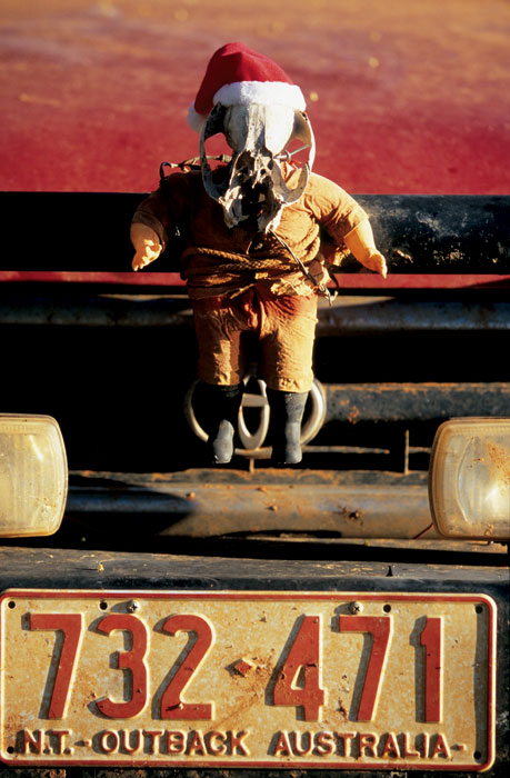
Hardcore Santana the travelling mascot, constructed of parts collected along the way. Image by Robyn Rosenfeldt

Driving into the Gammon Ranges National Park, the mountains rise up around us, erasing the monotony of the vast open plains. Despite our desire to camp rough we head into the Arkaroola Wilderness Sanctuary and Arkaroola itself. After camping wherever we want most nights, we’re a bit perturbed to have to set up in a designated site in Arkaroola, but the pull of their swimming pool and air-conditioned bar wins out.
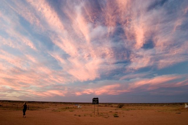
Sunset over the desert from outside the William Creek Hotel. Image by Robn Rosenfeldt

Our night in semi-civilisation is really just preparing us for our gradual immersion back into the populated world. The next morning we leave the ranges behind and head south, our tyres taking their first spin on bitumen as we hit the Barrier Highway on our way to Broken Hill.

Weekly travel news, experiences
insider tips, offers, and more.

Mungo Dreaming

After crossing the border into NSW at Cockburn, we ponder the origins of such a name, hoping it didn’t involve a nasty incident between a hot billy and an early explorer. We pass through Broken Hill for lunch and take the road southeast to Menindee and the surrounding lakes to a spot called Copi Hollow, where we camp by the shores of the Menindee Lakes. It’s here that Burke and Wills spent their final months before heading off on their ill-fated trip across unknown terrain to the north. From Menindee, we take the road to Pooncarie and turn off to Lake Mungo National Park, home to some of the oldest remnants of human existence. The following morning, after climbing the impressive sand dunes and exploring the old woolshed, we decide we’ve had enough. It’s time to make our way south, into Victoria.

Across Victoria to journey’s end

Pulling into civilisation – and yes, you can call Mildura that – our rugged attire makes us look like country hillbillies in contrast to the slick, made-up townsfolk. After sipping a very disappointing latte (which I’ve been looking forward to for days) we buy more supplies and find a spot to camp, just east of town on the banks of the mighty Murray.


As the golden afternoon sun lights up the huge river red gums lining the bank, we dive deep into the cool, refreshing water. The lush vegetation seems like a green paradise in comparison to where we’ve been. We have a beautiful night feasting on snags and steaks and watching shooting stars pass above the spreading limbs of the red gums overhead.
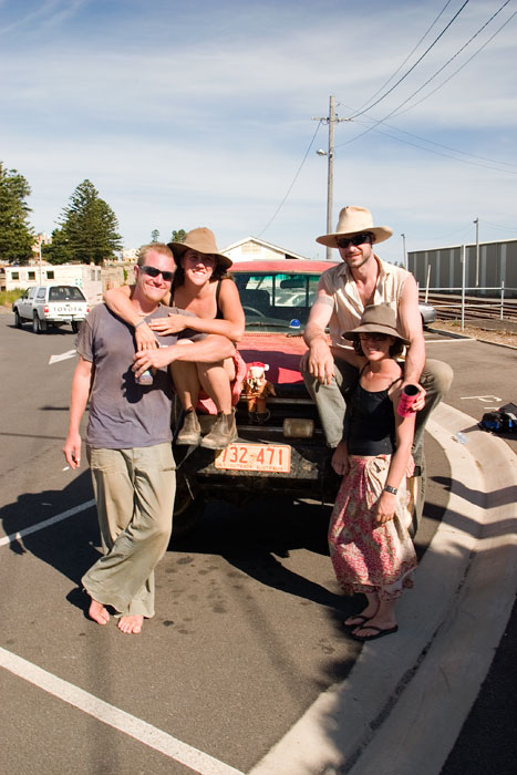
The travelling team at journey’s end. Image by Robyn Rosenfeldt

Our final day on the road starts early. Driving south, we skirt the western edge of the Grampians and drive through the reassuring yellow of the Victorian wheat fields, hitting the coast at Port Fairy. As we pull up to the water’s edge, the endless expanse of blue stretches before us, as vast and flat as the deserts we’ve driven through.


It’s been an amazing journey. In ten days we’ve crossed our gigantic continent from the red centre to the distant coast – a lot of the time on back roads seemingly to nowhere. But that almost seems the best approach; you experience so much more and the journey is that much more satisfying. We’ve seen the landscape, the colours and the weather change dramatically. And I think a little bit of each of us has changed too.

Want to see more stories from Australian Traveller in your Google search results?

  1. Click here to set Australian Traveller as a preferred source.
  2. Tick the box next to "Australian Traveller". That's it.
Australian Traveller

Australian Traveller

View profile and articles
hero media

Taking the route less travelled along the Great Ocean Road

The Great Ocean Road has captured the hearts of Australians with its astounding scenery since 1932, but going off-course can enrich your experience with untouched nature, foodie delights and charming towns. 

It’s a chilly 16 degrees. My husband pulls on a steamer and jogs – as all seasoned surfers do – into the water. We’re at Bells Beach, the legendary break on Victoria’s Surf Coast that’s home to the Rip Curl Pro, the world’s longest-running event in competitive surfing. Each year, over the Easter long weekend, up to 40,000 people descend on the region for the event. Today, though, we have the beach almost to ourselves, and the less-than-favourable temperature doesn’t deter my husband from surfing this famous break.  

Bells Beach
Bells Beach is known for its epic surf break and is at the start of the Great Ocean Road. (Image: Tourism Australia)

Torquay to Anglesea and Aireys Inlet 

Split Point Lighthouse
The red dome of Split Point Lighthouse in Aireys Inlet. (Image: Tourism Australia)

The nearby surf town of Torquay marks the starting point for the Great Ocean Road. Unfolding our map, which we have marked out with a highlighted route for our children to follow, we set off for lesser-known Anglesea, a chilled-out town 20 minutes south of here. Its wide, sandy beach is a gentler swimming option for our young family. Groms can learn to surf here with Go Ride a Wave, which also runs stand-up paddle boarding on the Anglesea River.  

Split point lookout
The lighthouse overlooks the Shipwreck Coast. (Image: Tourism Australia)

After a couple of nights in Anglesea, we hit the road again, first stopping at Aireys Inlet. Here we stretch our legs at Split Point Lighthouse, which was made famous by the 1990s television series Round the Twist, before driving under the Memorial Arch that welcomes us, officially, to the Great Ocean Road.  

This 243-kilometre coastal road was built by returned First World War servicemen and serves as a permanent memorial to those who fought and died during the war. Carved into rock using hand tools and horse-drawn carts, it was a huge engineering feat and provided much-needed access to isolated coastal communities. 

Lorne to Birregurra 

Lorne is a delightful beachside stop for lunch and browsing boutique stores. It’s also the gateway to Great Otway National Park, which comprises a varied landscape of old-growth forests, cool-temperate rainforests, heathy woodlands and rugged coast. With the highest rainfall in Victoria, the region is home to many waterfalls – 10 of which are within 10 kilometres of Lorne.  

Turning slightly off the main drag, we wind along a gum-shaded road to Erskine Falls. Here, our son leads the way through the hyper-green rainforest and down 200-plus stairs to the cascade that drops 30 metres into a lush fern gully. We hop over large boulders to get closer to the falls, enjoying the entire place to ourselves; it’s worth the return climb.  

From Sheoak Falls Picnic Area, there are walking trails to Henderson Falls, Phantom Falls, Won Wondah Falls and Kalimna Falls, some of which follow an old timber tramway from forest-logging days, which only came to an end in 2008.  

Erskine Falls
Erskine Falls is one of many falls within a day trip of Lorne. (Image: Visit Victoria)

You can follow your appetite north to the town of Birregurra, which is part of the Otway Harvest Trail that connects farm gates, markets, wineries, breweries and distilleries. It’s home to three-hatted modern Australian restaurant Brae, helmed by celebrated chef Dan Hunter, set among native gardens and an organic farm, and Otways Distillery, which produces small-batch spirits using local produce and botanicals.  

Brae restaurant
Brae is a three-hatted restaurant in Birregurra. (Image: Tourism Australia)

Apollo Bay to The Otways 

Back on track, the cliff-hugging stretch between Lorne and Apollo Bay is breathtaking. At Teddys Lookout, we overlook the winding road ahead and St George River spilling into the ocean. We spend languid days in Apollo Bay, a buzzy seaside town that boasts a three-kilometre-long, crescent-shaped beach with a backdrop of rolling green hills. One evening, as the sun sets, we take the steep 10-minute walk to Marriners Lookout, which affords panoramic views of the ocean, hinterland and town.  

A 15-minute drive along the road, Maits Rest is a lush rainforest gully that has been protected since the early 20th century. Wandering along the 800-metre boardwalk, we inspect the delicate moss-covered forest floor and the gnarled roots of 300-year-old myrtle beech trees, then crane our necks to see their canopies, some 50 metres above us. It’s therapy in nature.  

Cape Otway to the Twelve Apostles 

Twelve Apostles
One of the famous Twelve Apostles, limestone sea stacks that rise from the Southern Ocean. (Image: Ben Savage)

The southernmost tip of Cape Otway is a delightful detour, home to the 1848-built Cape Otway Lightstation, the oldest surviving lighthouse on mainland Australia. We climb the narrow winding staircase to the gallery deck, explore the keepers’ quarters and telegraph station, and enjoy a coffee and some ‘famous’ scones at the charming onsite cafe.    

It’s a pinch-me moment to finally see the Twelve Apostles in person. This unmistakable cluster of limestone stacks rising abruptly from the sea were never 12, however. When coined this in the 1890s as a marketing ploy, there were only nine; today, only seven remain after two collapsed in 2005 and 2009. We admire these Aussie icons from the viewing platform, in awe of Mother Nature’s ever-evolving artwork.  

The Grotto
The Grotto is another natural attraction within Port Campbell National Park. (Image: Carmen Zammit)

Edging the wild Southern Ocean, this part of the coast – dubbed Shipwreck Coast – is made up of many sea-carved natural wonders including London Bridge, The Grotto and Gibson Steps. After exploring the lookout trails of Loch Ard Gorge/Poombeeyt Kontapool – its English name taken from the site of the 1878 shipwreck – we nestle into the sandy beach encircled by towering sandstone cliffs, as our children splash about on the water’s edge, and soak it all in.  

Port Campbell to Timboon 

Timboon Fine Ice Cream
Timboon Fine Ice Cream is part of a regional foodie trail. (Image: C McConville)

Just north of Port Campbell National Park, the region of Timboon is part of the 12 Apostles Food Artisans Trail, filled with purveyors of delicious foodstuffs such as Timboon Fine Ice Cream, Timboon Railway Shed Distillery and Apostle Whey Cheese. As an antidote to the indulgence, the 20-kilometre Poorpa Yanyeen Meerreeng Trail is a self-guided ride or walk between Port Campbell and Timboon through tall forests, over historic bridges and past sparkling lakes and farmland with grazing cattle.  

Warrnambool to Port Fairy 

Warrnambool building
A 19th-century building in Warrnambool. (Image: Peter Foster)

In Warrnambool, a town rich in maritime history, we take the four-kilometre Thunder Point Walk that traces the coast. The kids squeal when an echidna shuffles out from beneath the wooden boardwalk, and we stop to admire a seal lazing on a rock at the port.  

Further along, the streets of quaint fishing village Port Fairy are lined with 19th-century cottages, old stone churches and Norfolk pines. Follow the historic walking trail to see some of the 60-plus National Trust buildings. Port Fairy is also home to Port Fairy Folk Festival (6-9 March), one of the country’s longest-running music and cultural festivals. You could time your road trip with the event for a fittingly celebratory end to any journey.  

The Great Ocean Road can easily be done in three days, but we’ve spent a week on the road. The highlighted line on our now creased and well-worn map doesn’t follow the famous route precisely. It has sprouted branches in many directions, leading us to untouched rainforest and charming rural towns filled with culinary delights, and where we experienced some of our most memorable moments on the Great Ocean Road.    

A traveller’s checklist 

Staying there

Oak & Anchor
The Oak & Anchor in Port Fairy.

The Monty is a highly anticipated, newly refurbished motel with a chic Palm Springs-inspired aesthetic set across the road from the Anglesea River. Basalt Winery in Port Fairy grows cool-climate wines such as pinot noir and Riesling in rich volcanic soil. Stay among the vines in its tiny home, complete with a kitchen, lounge area and outdoor firepit. 

The Oak & Anchor Hotel has been a Port Fairy institution since 1857. Cosy up by the bar in winter or bask in the sunshine of the Lawn Bar in summer. The rooms are beautifully boutique with considered details, such as luxe baths for sinking into post-road trip. 

Eating there

The Coast in Anglesea is a modern Australian restaurant focused on local ingredients. Grand Pacific Hotel has been a local landmark in Lorne since 1879 and recently underwent a restoration. It serves a mix of traditional pub and Italian fare alongside ocean views.  

Graze is a cosy 40-seat dining room in Apollo Bay with a modern Australian menu complemented by regional wines. Apollo Bay Distillery offers tasting flights, a gin blending masterclass and serves woodfired pizzas.