Australia’s tiny towns have it all – from the quirky to the scenic, discover our picks of the best.
What they may lack in square meterage and population size, they more than make up for by way of charm and old-school hospitality. This collection of noteworthy tiny towns offer up a quirky mix of 19th Century Georgian mansions, strange alcoholic concoctions, Dreamtime creation monuments and oh so much more.
Don’t believe us? Keep reading for the most unique tiny towns around Australia.
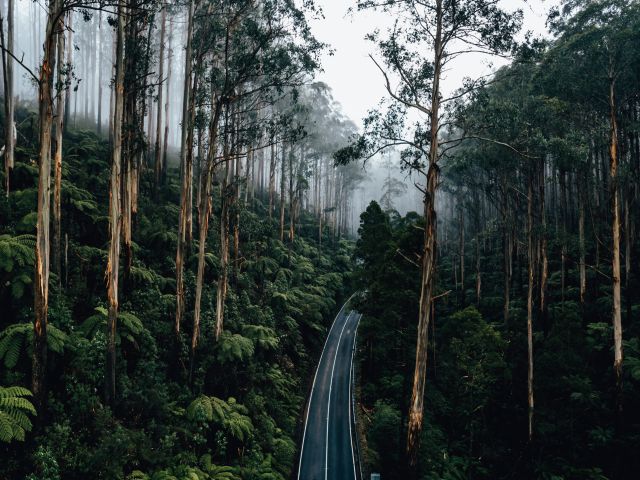
Deloraine, Tasmania
Where: 300 kilometres (3 hours) northwest of Hobart, 50 kilometres (45 minutes) west of Launceston
Population: around 2000
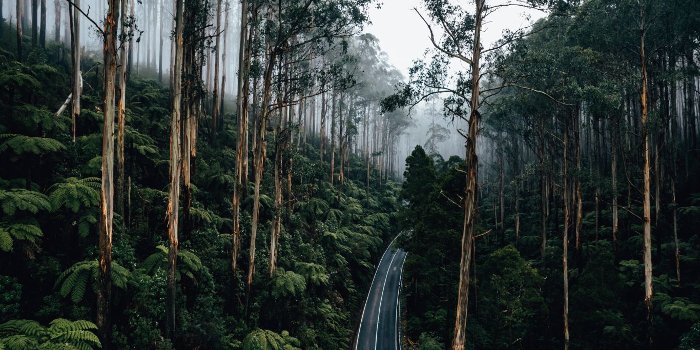
Deloraine is a patchwork of farmlands with a smattering of art galleries and cheese shops to indulge at. It’s also set about by perfect fly-fishing spots, pretty waterfalls, a breadth of easy and more challenging walks, as well as the wandering Meander River, all lying within the protective shadow of the Great Western Tiers.
You can also use Deloraine as the perfect leaping-off point for a myriad of iconic day trips. First, to Mole Creek (home of Tasmania’s famous Leatherwood Honey and Trowunna Wildlife Park with its Tassie Devils), then further west to the iconic Cradle Mountain, or back east towards the Heritage Highway (Hwy 1) and its plethora of historic homes and monuments.
Drive a little further south of Deloraine along Highland Lakes Rd to reach Peppers Calstock: an exquisite 19th Century Georgian mansion renowned for its extensive wine list and gracefully restored oversized rooms.
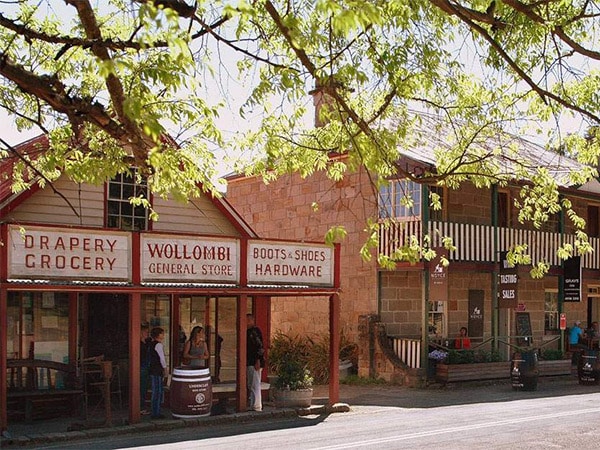
Wollombi, NSW
Where: Wollombi Valley is on the southwestern periphery of the NSW Hunter Valley region, around 140 kilometres (less than 2 hours) north of Sydney and 80 kilometres (1.5 hours) west of Newcastle
Population: less than 300
Tucked into the lower fringes of the NSW Hunter Valley wine region, the 20th Century – let alone the 21st – barely left a mark on Wollombi. Cars should be disallowed here. All should arrive by horse, hitch ’em out front of the tavern or general store and waltz inside.
Wollombi (literally, “meeting of the waters") was of great significance to traditional owners. A ceremonial meeting place overshadowed by Mt Yengo, it played a central role in the Dreamtime creation story. More than 300 cave paintings and rock carvings stand as mute reminders of this fascinating Indigenous heritage.
This place oozes unadulterated old-world charm and is also the birthplace of a strange alcoholic concoction created by local legend Dr Mel Jurd after he heard tales of an old bush remedy used in World War II and decided to experiment with a mad mix of brewing techniques until Dr Jurd’s Jungle Juice was born. Like it or hate it, you simply have to try this stuff. Find it at the Wollombi Tavern, where a low-pitched corrugated roof, wraparound verandah and rough timber aesthetic make for a classic Aussie boozer.
Explore the town’s other gems: from the old courthouse with its local history museum to the early colonial general store – which still has the original products on display. Find ancient buildings reimagined as tasty cafes, art exhibits in the town’s cultural centre and the annual Sculpture in the Vineyards runs in summer – and don’t miss out on a yarn with the town’s colourful locals.
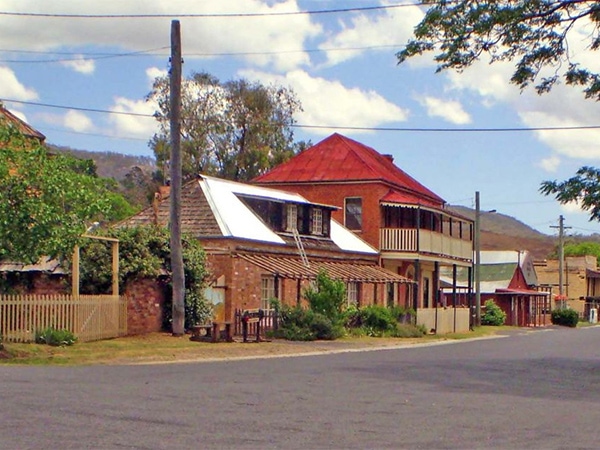
Sofala, NSW
Where: around 234 kilometres (3 hours) northwest of Sydney and 45 kilometres north of Bathurst
Population: less than 300
Sofala is the friendliest place you’ve (n)ever been to. Australia’s oldest surviving gold town, Sofala was also the subject of a 1947 Russell Drysdale painting which was awarded the Wynne prize that same year.
The old-fashioned buildings he depicted are washed with sunset colours of orange and brown along the sides of a narrow, dusty street. To this day the street looks much the same – give or take a few cars.
Gold was discovered in the local Turon River at the beginning of 1851 and by the end of the year tens of thousands of people had rushed to Sofala to wallow in her riches. Houses and shops popped up to support the miners and the gold rush lasted until 1948.
Explore Sofala and the Upper Turon on a historical walking tour of its old buildings, museum and the gold diggings on the outskirts of town. It’s said that gold can still be found in the Turon River, and panning is a popular pursuit for visitors who can also swim in the gold-flecked waters.
Need tips, more detail or itinerary ideas tailored to you? Ask AT.
AI Prompt
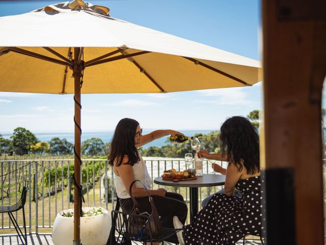
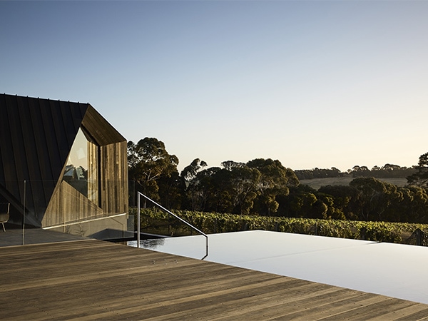
Merricks, Victoria
Where: find Merricks in the south eastern part of the Mornington Peninsula between Hastings and Flinders
Population: less than 500
Hiding in plain sight on the ‘other side’ of the Mornington Peninsula is a collection of small towns that boasts some of the best food and drink offerings in these parts.
One such place is Merricks, which many know as the home of the startlingly modern black form of Jackalope Hotel. Spreading out across a still-functioning vineyard, the hotel itself is a riot of sleek purpose and modern design, while the restaurants attached – the hatted Doot Doot Doot, with its arresting ceiling of metallic lightbulbs and seasonal five-course tasting menu, and the relaxed communal dining space of Rare Hare – are arguably the stars of the show.
Come by car and you will have the means to scoot down the road to Pt. Leo Estate to try the divine two or three course menu at Pt. Leo Restaurant, and take home a few bottles of the wine from their cellar door.
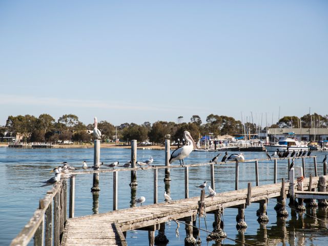
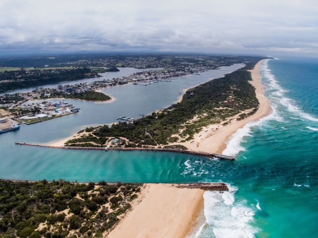
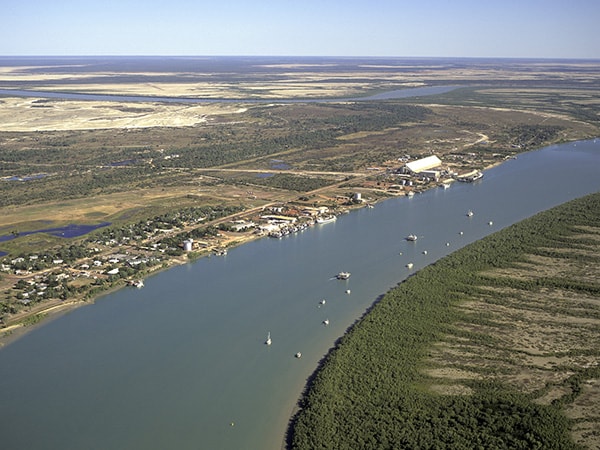
Karumba, QLD
Where: 750 kilometres (8.5 hours) due west of Cairns in the Gulf of Carpentaria
Population: less than 600
Fishing is a way of life in Karumba, the northern Queensland town of Karumba (known as ‘the outback by the sea’) is located on the banks of the Norman River and surrounded by 30 kilometres of wetlands.
Originally a telegraph station until the 1930s when it became a stopover for Qantas and BOAC flying boats on their way to London, Karumba became even more popular in the 1960s when vast quantities of prawns and barramundi were discovered in the river. To this day, Fishermen come from near in far with hopes of catching “the big one".
During September and October Karumba is visited in the early hours of the morning by the unbelievable cloud phenomenon of Morning Glory; this tubular cloud rolls out from the horizon, across the sea and chases the night away, bringing dawn with it.
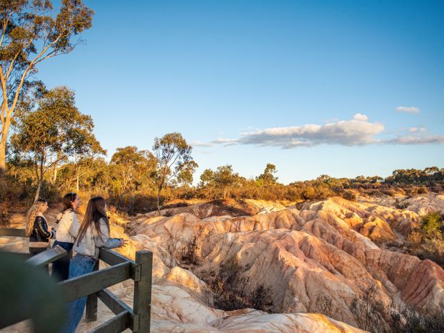
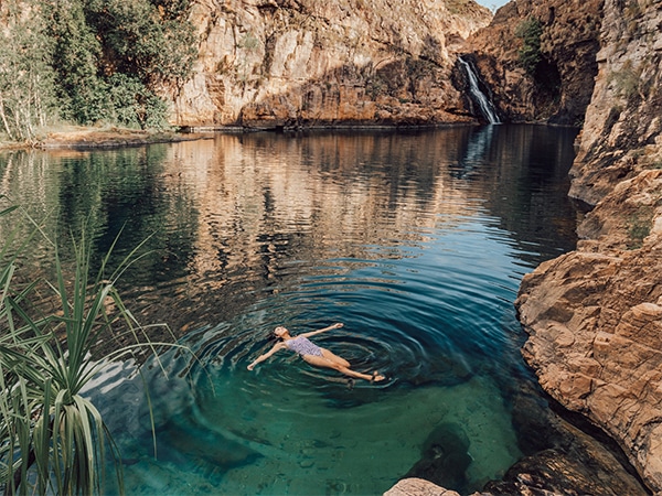
Jabiru, NT
Where: 255 kilometres (just under 3 hours) southeast of Darwin
Population: 1100
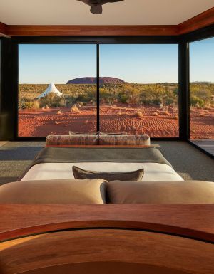
Kakadu is about as scenic as you can get. This mystical travel destination is Australia’s largest national park with the pretty town of Jabiru residing at its heart.
The town itself is in the middle of nowhere, yet those who call it home are right in the middle of everywhere when it comes to experiencing the wonders of Kakadu. It’s also close to Yellow Waters, legendary for its birds but it’s also home to a whole host of wildlife; from wild horses and pigs to dingoes and crocs.
Initially established to service the Ranger Uranium Mine in 1979, Jabiru has turned into a base for experiencing Australia’s rich Indigenous history, and operators such as Kakadu Animal Tracks have tapped into its potential by offering interpretative rock, animal tracks and bush tucker tours.
Weekly travel news, experiences
insider tips, offers, and more.
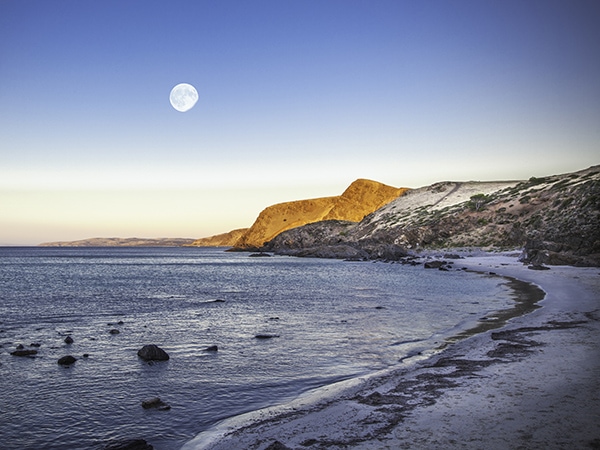
Second Valley, South Australia
Where: 92 kilometres (1.5 hours) from Adelaide on the Fleurieu Peninsula
Population: less than 200
Calling Second Valley a sleepy town is actually a compliment; it is so unaffected by over-tourism and saturated accommodation offerings – the caravan park is your best bet – that it leaves you with nothing better to do than simply take in the breathtaking beauty of your surroundings.
It’s one of South Australia’s most Instagrammed destinations for a reason. Follow the open valley that narrows at the coast, through the small Parananacooka Creek and onto the beach. Go east for calm, clear waters popular with swimmers and snorkelers. To the west is a north-facing long boulder beach, attached by rock reefs to a small headland.
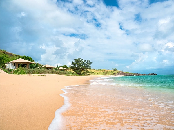
Bremer Island, East Arnhem Land, Northern Territory
Where: Bremer Island is a 15-minute flight from Gove Airport off Nhulunbuy in East Arnhem Land
Population: about 25 Yolngu people of the Rirratjingu clan – in addition to a max of eight tourists
You won’t stumble on Bremer Island by accident. Getting to this wilderness retreat means flying or driving into the East Arnhem Land town of Gove, then taking an hour-long boat trip to paradise.
But once you’re here you’ll never want to leave. This far-flung island is home to Banubanu Beach Retreat, an eco-retreat of just five beachfront glamping suites – and one elevated penthouse– set on white sand dunes, with access to the island’s gloriously untouched beaches.
Seriously quiet and seriously remote, tiny Bremer Island is inhabited only by a small number of Yolngu people. The simple accommodation is built using jetsam washed up on the shore in addition to other materials found locally. Guests are invited to learn about the Yolngu people through basket weaving, spear making and catching crabs with local fishermen.
Want to see more stories from Australian Traveller in your Google search results?
- Click here to set Australian Traveller as a preferred source.
- Tick the box next to "Australian Traveller". That's it.