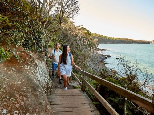
Lace up your shoes and get ready for an outstanding bushwalk, because the Spit Bridge to Manly walk is always an excellent idea.
The Spit to Manly walk, also known as the Manly Scenic Walkway, is a must-see 10-kilometre coastal track offering striking views of Sydney Harbour, stunning secret beaches, sites of cultural significance and snapshots of Australian plants and wildlife. It’s popular, so expect to encounter a combination of Sydneysiders enjoying their favourite day hike and wide-eyed international visitors soaking in the natural beauty for the first time.
It’s not just a track for hiking, remember to pack your swimmers to enjoy the secluded swimming spots along the way, and throw in your snorkels for good measure, so you’re prepared when you reach Fairlight Beach, one of the best snorkelling spots in Sydney.
Here is how to get the most out of this stunning coastal walk.
The Spit Bridge to Clontarf
Distance: 2.3 kilometres (approximate)
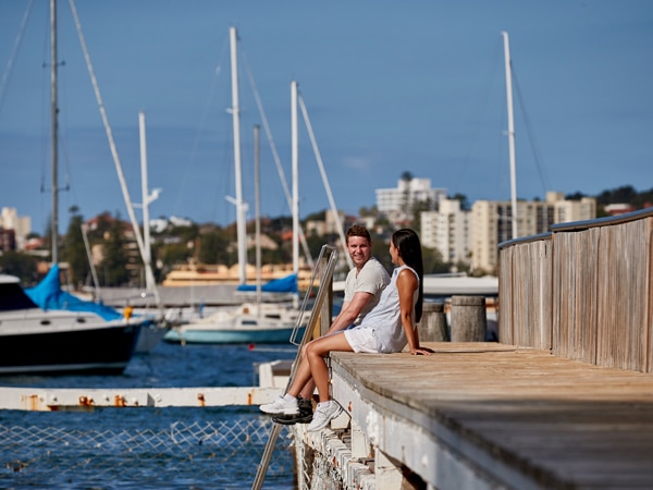
Beginning at the Spit, take an opportunity to grab a coffee from either Plonk Beach Cafe or Grumpy’s Wharf Cafe, and use the bathroom facilities before starting. Walk down the steps at the northern end of the Spit Bridge to reach Ellery’s Punt Reserve and make your way east. It doesn’t take long for the sounds of steady traffic to be replaced by an earthy soundtrack of bird calls; look out for lorikeets and kookaburras in the canopy above.
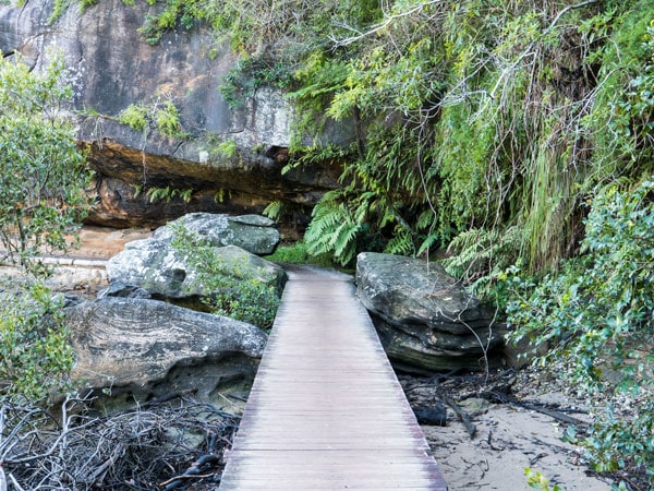
The first highlight is inside a rock cave which can be found just on from Fisher Bay. Here, you’ll find signs of small, sun-bleached, white shells indicating an Aboriginal midden.
Keep walking and you’ll pass by dog-friendly Sandy Bay. Dogs aren’t allowed in the national park, so if you’d like your dog to run free here, it’s best to come back another time with a car.
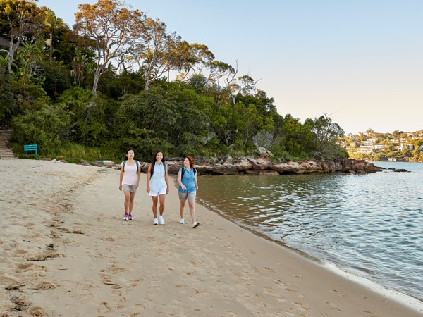
You’ll soon find yourself at the stretch of golden sand that is Clontarf Beach. Clontarf is family-friendly, with shallow and calm waters, and an enclosed tidal pool swimming area. You can grab a takeaway drink and a bite to eat at Bosk Kiosk or stop by Sandy Bar Cafe if you prefer to take a break from walking. Keep in mind that this is the last cafe until you are significantly further along the trail at North Harbour Reserve.
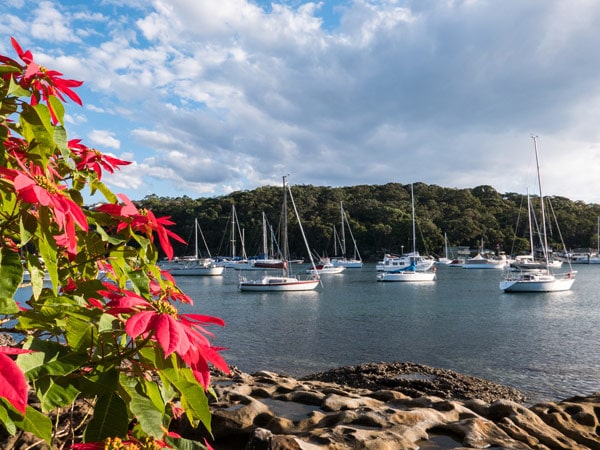
As you make your way along the foreshore, you’ll notice a large and enticing shaded playground. The grassed area behind the beach is shady, with barbecues and picnic tables available, as well as bathroom facilities (the last until Reef Bay). It is advisable to fill up your water here too, as there are no water fountains until the end of the track at Fairlight Beach.
Clontarf to Dobroyd Head
Distance: three kilometres (approximate)
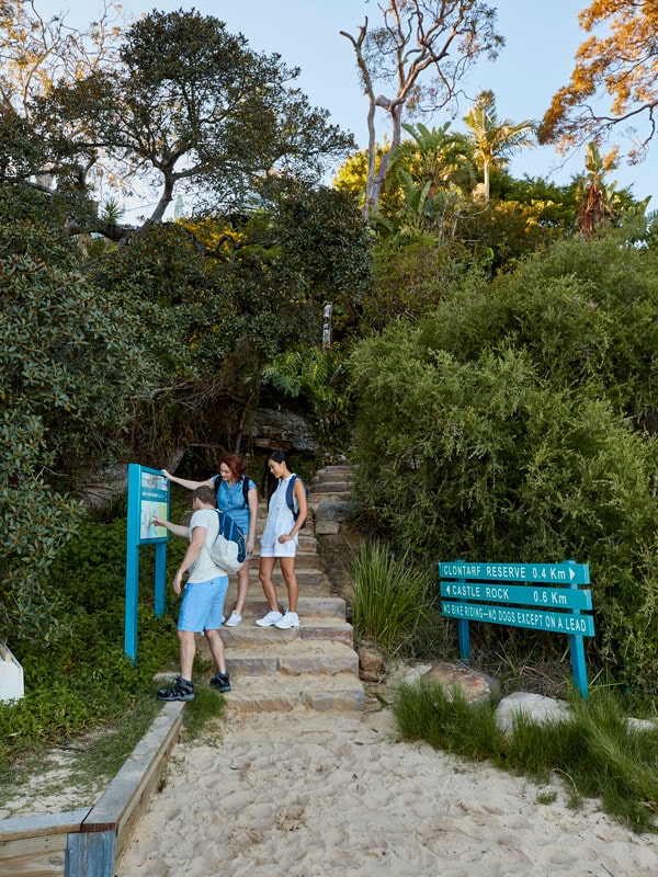
This leg of the track is often people’s favourite part. The path hugs the coastline to reveal beautiful water views and some parts of the walk feel like lush rainforest. The first stretch from Clontarf is along a sandy beach only accessible at low tide.
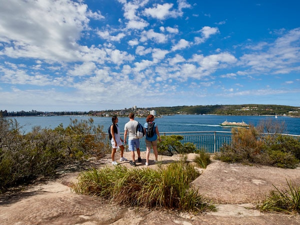
You’ll have to take the alternative road along Monash Crescent if you’re walking through at high tide. This is clearly signposted, and the end of the road takes you back to the track. Be on the lookout for wildlife as you may come across eastern water dragons and a range of birds, including bush turkeys.
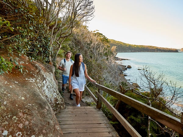
If you didn’t stop for a swim at Clontarf, there are some great options in this section. Consider taking the steps down to secluded and rocky Isoldes Beach. Be mindful of the tides and where you leave your belongings as parts of this beach are prone to disappear underwater.
Further along the track is pristine and popular Castle Rock Beach, which is bigger than Isoldes and home to an ancient Aboriginal rock carving. While there can usually be a handful of keen swimmers floating in the water, this beach is certainly more private than Clontarf.
The next part of the track does become more challenging as you walk through bushland. You’ll pass a detour sign for Grotto Point, which will take you down to the historic Grotto Point Lighthouse and hidden Washaway Bay. Grotto Point Lighthouse dates back to 1911 and was originally constructed to help ships coming through Sydney Harbour; it’s still operational today.
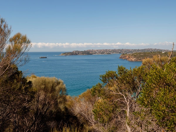
It’s important to note that the detour is not an official part of the track, nor factored into the overall track distance length. While this detour section is good for birdwatching and scenic views, the path is not clearly signposted like the Spit to Manly track and a map is needed.

Keep an eye out for the signpost to see the Grotto Point Aboriginal rock engravings, which are only a very short distance from the track. If you look carefully, you will see a whale, small fish, boomerangs and a large kangaroo. There is a boardwalk and timber enclosures to protect these well-preserved engravings, and an information sign to learn more.
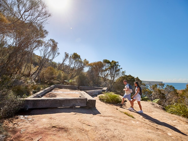
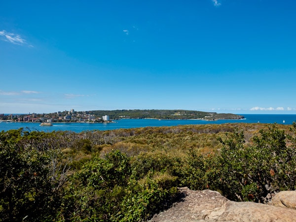
Breathtaking lookouts showcasing incredible panoramic views of Sydney Harbour round out the leg of this track. A slight detour up to Arabanoo lookout at Dobroyd Head offers expansive views of North and South Head – it’s an especially great spot during whale-watching season.
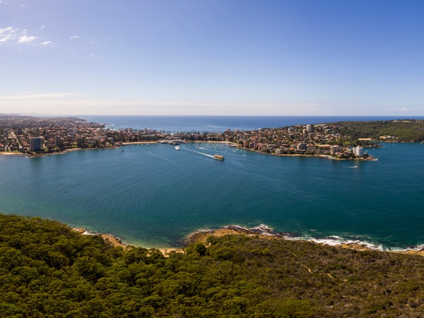
The lookout is named after Arabanoo, an Aboriginal man who was abducted from Manly, on Governor Arthur Phillip’s orders, to act as an intermediary between the new government and local Aboriginal peoples. On your way through you will also pass by Fairlight Lookout, Dobroyd Head Lookout and Dobroyd Lower Lookout; all with picturesque views and incredible photo opportunities.
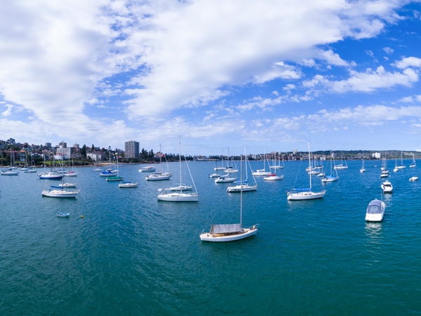
Need tips, more detail or itinerary ideas tailored to you? Ask AT.
AI Prompt
Dobroyd Head to Manly
Distance: five kilometres (approximate)
The final section of the track comprises a mix of bushland, coastal track and residential area. Accordingly, it’s more exposed without the canopy’s shade, so a hat is particularly important here.
While facilities across this whole track are limited, there are more options in this final section, with toilets available at Reef Beach, Forty Baskets Beach, North Harbour Reserve and Fairlight Beach.
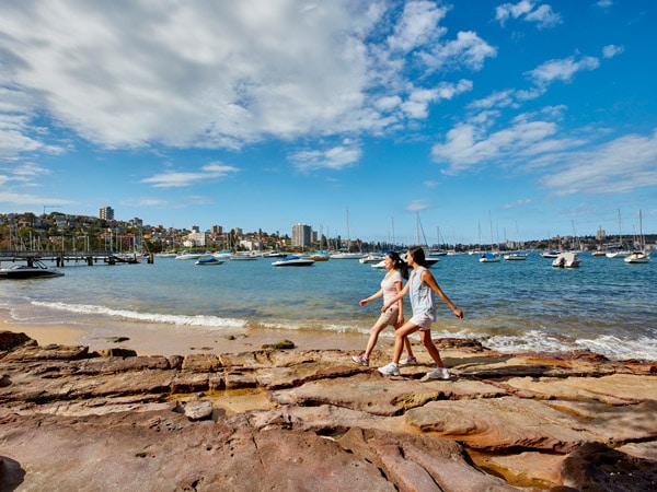
To celebrate passing the halfway point, stop for a refreshing swim at Reef Bay. Keep an eye out for an ice cream vendor boat that roams the beaches. Like an ice cream truck on land, you’ll hear the bell and know it’s coming, giving you enough time to find some money (cards are also accepted).
Further along at Forty Basket Beach, you’ll find an enclosed swimming bath and a children’s playground. The beaches from here onwards tend to be busier, as there is nearby car access. Forty Beans Cafe is accessible and can be found at the North Harbour reserve, so pop in for a coffee or to grab a bite.
This marks a shift in the trail towards residential areas, so keep an eye out for signs to ensure you are following the correct street. Eventually, you will rejoin the coast, replacing the bush with a backdrop of houses and apartments.
Bustling Fairlight Beach attracts swimmers, snorkelers and those wanting to relax on the sand. Head further along to smaller Delwood Beach to swim with less crowds. You’ll also see signs for penguins – yes, little penguins call Delwood Beach and Manly home. It’s only a small penguin colony, and numbers are sadly diminishing each year. The penguins return to Manly for breeding between May and February and are most likely spotted at sunset when they return to their burrows.
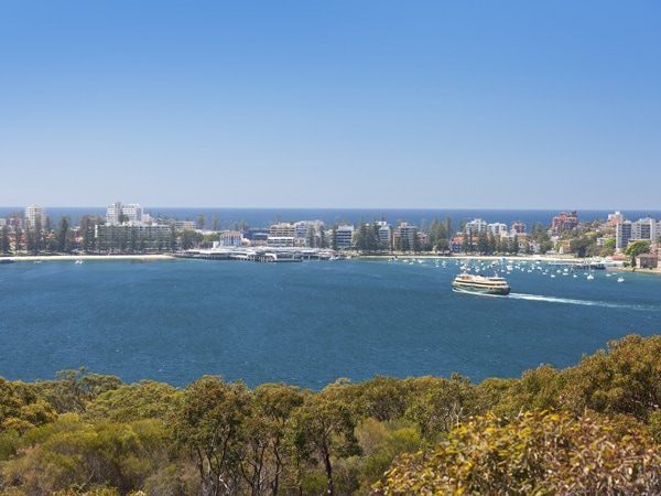
Make your way towards Manly Wharf, where the coastal trail ends, and soak in the vibrant Manly atmosphere. If you would like to extend your walk further and complete the whole Manly Scenic Walkway, consider undertaking the North Head circuit.
Beginning above Shelly Beach and looping around North Head, this eight-kilometre walk brings the total distance of the Walkway track to 20 kilometres.
Manly has a wealth of fun and dynamic activities to do, there’s so much to see and enjoy. Head to Manly Beach or stop for a drink at one of Manly’s cafes or pubs: you’ve certainly earned it!
Weekly travel news, experiences
insider tips, offers, and more.
Frequently asked questions
How long does it take?
Walking usually takes between 3.5 and four hours, without breaks. This is a Grade three track, meaning it is moderate to challenging. There are parts with sand, paved walkways, trails and boardwalks. There is an alternate dog route track available, which doesn’t enter the national park, and takes approximately two hours.
How to get there and back?
While you can begin from either The Spit or Manly, a popular option is to begin at the Spit and finish at Manly, where the lively atmosphere and ocean make the perfect place to relax after the long walk. This route is also the easiest for public transport, as there are regular buses from Wynyard departing for the Northern Beaches.
From Manly, there are returning buses towards the city but a popular option is to catch the ferry back to Circular Quay. As there is paid parking at the Spit reserve, some walkers prefer to park at The Spit, complete the track and catch a bus back to where they started.
Parking tips?
Due to its popularity, we recommend arriving early to nab a park. There are two car parking areas at The Spit: Spit West car park and Spit East reserve.
Manly has council-owned parking garages where you can park for free for a set number of hours, however, the walk is anticipated to take double this amount of time, so plan ahead. Manly also has timed and paid street parking options, and some free street parking far from the beach.
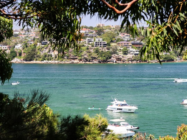
Once you’ve tackled this walk, consider exploring another one of Sydney’s magical coastal walks.
Want to see more stories from Australian Traveller in your Google search results?
- Click here to set Australian Traveller as a preferred source.
- Tick the box next to "Australian Traveller". That's it.

Jessica Noelle
View profile and articles