Outback survival stories that’ll stop your heart

hero media
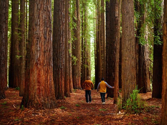
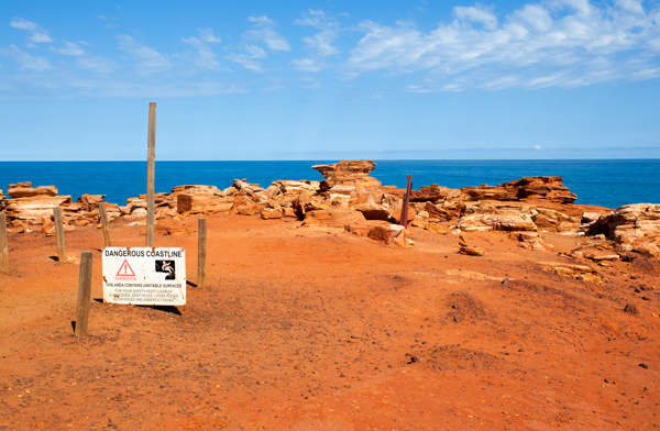
The outback is a very beautiful place – but venture into it unprepared and you’ll soon find out just how hazardous it can be. Lauren Camp explores a few of the more miraculous (and ridiculous) stories of wilderness survival in what can often be a harsh and unforgiving place.

1. Spiritual quest goes awry

One of Australia’s most famous outback desert rescues occurred in 1999, when 33-year-old Alaskan fire fighter Robert Bogucki was found after 43 days wandering lost and alone in the Great Sandy Desert on a quest to “make peace with God". A little unluckily for Bogucki (and pray this never happens to you), he was found in some gorges east of Broome, not by police, Aboriginal trackers or the professional team of rescuers brought in from the US, but by Channel Nine’s A Current Affair news team.

Gantheaume Point, Broome.

ACA came under intense scrutiny when it was revealed that, instead of flying him to a nearby camp to receive medical treatment, they spent almost 20 minutes interviewing Bogucki before flying him an hour back to Broome with their own TV reporter.


All-told, the rescue cost police and Bogucki’s parents around $150,000 – and Bogucki, who lost 20kg and survived by drinking muddy water and eating flowers and plants, told BBC News that he’d definitely “scratched the itch" that had him out there in the first place.

2. Addicted to getting lost

In September 2006 in Alice Springs, 50-year-old English tourist Martin Lake earned himself the nickname “the Bumbling Brit" when he got lost, in the words of local police, “within shouting distance of help".

Alice Springs, NT.
Australia, NT, aerial view to farm in outback south of Alice Springs.

Wearing a black T-shirt and shorts, with no water, no hat and an almost-flat phone battery, he wandered off the path while looking for the old telegraph station north of town and wasn’t found for three days. But that’s not the absurd part. After apologising and receiving a stern lecture from rescue services, less than a week later he became lost again, under a mile from the exact same spot.


The helicopters and search parties were organised once more, to the tune of tens of thousands of dollars for local taxpayers, and Lake was re-rescued, this time after four days of wandering. It’s believed that he returned to the area because he dropped something the first time around and wanted to retrieve it.

3. Always carry a gizmo

Uluru (Ayers Rock), Uluru-Kata Tjuta National Park, Northern Territory.
Uluru (Ayers Rock), Uluru-Kata Tjuta National Park, Northern Territory, Central Australia.

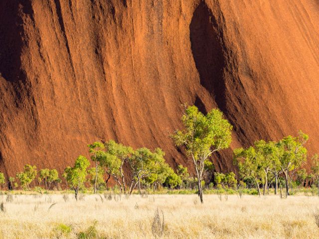
In January 2009, an experienced Romanian hiker, who’d previously trekked through the likes of South America and Asia, got a nasty fright when he became lost for six days during a 45km walk near Uluru.


He ran out of food and water on day three and had to head sluggishly back. Once within mobile phone range – which is pretty incredible because the reception is very dodgy out there – he managed to alert rescuers by getting a message to his family back in Romania, including his GPS location.


Rescuers said it was this fact alone that saved the man, which proves how important it is to be well prepared in the food, water and GPS stakes before venturing into the unknown.

4. Survival of the fittest

When 35-year-old Ricky Megee from Brisbane was heading to Port Hedland in late January 2006, he stopped to help a group of stranded motorists near the WA/NT border and agreed to ferry the smallest of the group to the nearest town.

Left for Dead, the true story of Ricky Megee's outback survival.
Left for Dead, the true story of Ricky Megee’s outback survival.

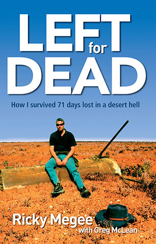
That fateful day ended with Megee being drugged by his passenger and left for dead in a ditch, covered by a tarpaulin weighted down with rocks. He then wandered aimlessly for ten days before setting up camp under an old cattle trough beside a dam, which allowed him a constant flow of water and a diet of toads and lizards.


He survived in this fashion for ten weeks, before being discovered and rescued by two passing station hands – 60kg lighter, lucky to be alive.


Check out his book Left for Dead.

5. No water, plenty of beer

In October 2002, 36-year-old German man Kim Hardt sat alone in his 4WD for three days after getting bogged at Lake Disappointment on the rugged Canning Stock Route. He’d heard about the challenge the CSR presented to outback drivers on a German TV show, which must have been missing a few salient survival details because Hardt showed up by himself with hardly any water, no phone or GPS, but carrying ten litres of beer and a packet of bikkies.


Nothing like being well prepared. Some fellow tourists discovered Hardt and were able to leave some more water while they trundled off to alert a rescue team. By the time the team returned, Hardt was drinking the salt water from Lake Disappointment. Apparently he’d thought it would take about three days to traverse the 1700km CSR, 900 sand dunes and all.

6. Where there’s smoke, there’s a fire engine

This might not quite qualify as a survival story, but back in 2000, 43-year-old Edward Furtak got it into his head that a good way to give up smoking would be to drive his ancient converted fire engine into the desert and camp by himself for six months. “I needed to actually get out in the middle of nowhere where I just couldn’t have a smoke," he said later in an ABC radio interview.


While he claimed he “had a great time", his parents certainly didn’t, reporting him missing after three months. A police search was mounted but proved fruitless. The mystery of his disappearance from Sydney was finally solved after another three months went by, and he emerged from the desert into the small town of Forrest, 1150km east of Perth, to call his mum on her 78th birthday.


Still keen for an outback holiday? Of course you are! You now have your wits about you, so check out our guide to outback holidays right here.

From coast to bush: these are Gippsland’s best hikes

Video credit: Tourism Australia

From coast to mountains, hiking in Gippsland offers a stunning array of landscapes, with trails that take you deep into the region’s heritage.

I step out onto the sand and it cries out underfoot. Kweek! I take another step and there’s another little yelp. Screet! Picking up the pace, the sounds follow me like my shadow, all the way down to the water. It’s obvious how this spot got its name – Squeaky Beach – from the rounded grains of quartz that make the distinctive sounds under pressure.

For many, Wilsons Promontory National Park is the gateway to Gippsland , and the best way to explore it is by walking its network of hiking trails, from coastal gems such as Squeaky Beach through to the bushland, among the wildlife. But it’s still just a taste of what you’ll find on foot in the region.

Venture a bit further into Gippsland and you’ll discover the lakes, the rainforest, and the alpine peaks, each changing with the season and offering summer strolls or winter walks. Just like that squeaky sand, each step along these trails has something to tell you: perhaps a story about an ancient spirit or a pioneering search for fortune.

The best coastal hikes in Gippsland

sunset at Wilsons Promontory National Park
Wilsons Promontory National Park is a sprawling wilderness with many coastal bushland trails. (Image: Mark Watson)

Wilsons Promontory National Park (or ‘The Prom’, as you’ll end up calling it) is an easy three-hour drive from Melbourne, but you might ditch the car when you arrive, with much of the park’s 50,000 hectares accessible only by foot. From the inky water of Tidal River (dyed dark purple by abundant tea trees), I like the easy walks along the coast, among lichen-laden granite boulders, to golden beaches and bays.

a couple on Mount Oberon
Panoramic views from the summit of Mount Oberon. (Image: Everyday Nicky)

The trail to the panoramic views at the summit of Mount Oberon is a bit harder, up steep timber and granite steps, but it’s a popular 6.8-kilometre return. The more remote hikes are found through the open banksia and stringybark woodland of the park’s north, or along the multi-day Southern Circuit , which ranges from about 35 to 52 kilometres, with sunrises and sunsets, kangaroos and cockatoos, and maybe even whales.

a golden sand beach at Wilsons Promontory National Park
Walk ‘The Prom’s’ golden sand beaches. (Image: Tourism Australia/Time Out Australia)

You might also see whales on the George Bass Coastal Walk , even closer to Melbourne on the western edge of Gippsland. This dramatic seven-kilometre trail along the clifftops takes in sweeping views of the wild ocean, occasionally dipping down from grassy green hills to coastal gullies and a secluded beach. It also now links into the Bass Coast Rail Trail for an extra 14 kilometres.

the George Bass Coastal Walk
George Bass Coastal Walk trails for seven kilometres along clifftops. (Image: Visit Victoria/Time Out Australia)

Over at the eastern edge of Gippsland, in Croajingolong National Park, you can wander along the lakeshores beneath koalas and around goannas (I keep my distance since one chased me here!). For those who are even more adventurous, the park is also the starting point for the 100-kilometre Wilderness Coast Walk , usually done over seven days.

the Croajingolong National Park, Gippsland
Wander along the lakeshores in Croajingolong National Park. (Image: Tourism Australia)

The best bush hikes in Gippsland

the Baw Baw National Park
The alpine heath of Baw Baw National Park. (Image: Everyday Nicky)

Deep in the Long Tunnel Extended Gold Mine at Walhalla, mining guide Richard tells me how this small town in the mountains east of Melbourne boomed when prospectors found gold here in 1862. These days, you’ll find most of the town’s treasure – its heritage – above ground, with the Walhalla Tramline Walk a wonderful way to explore it.

Just seven kilometres long, the walk takes you through decades of Gold Rush history, following the original rail trail from lush bushland to the mining sites, and through the charming village of just 20 residents with its wooden cottages and old shopfronts adorned with turn-of-the-century advertising posters. Blazing a trail where trailblazers once opened up the region, this is also the starting point for the 650-kilometre Australian Alps Walking Track.

Nearby, Baw Baw National Park has walks through gnarled snow gums and alpine heaths that show off the colourful wildflowers in summer and the pristine carpet of white in winter. Several trails are perfect for snowshoes, including a 45-minute route from St Gwinear up to vast views across the Latrobe Valley.

Further up into the mountains, the Toorongo and Amphitheatre Falls Loop Walk is an easy 2.2-kilometre path that serenades you with the sound of flowing water as you pass mossy rocks and tree ferns en route to two sets of waterfalls cascading over boulders in the remote wilderness.

The best cultural hikes in Gippsland

the Mitchell River National Park, Gippsland
Hike the Mitchell River National Park. (Image: Parks Victoria/Grace Lewis)

Across a pool in a natural sandstone amphitheatre, deep within a cave behind a waterfall, it’s said the Nargun has its lair. A fierce creature, half human and half stone, that abducts children and can’t be harmed by boomerangs or spears, the story of the Nargun has been told around the campfires of the local Gunaikurnai people for generations.

As a culturally significant place for women, hikers are asked not to go into the Den of Nargun, but a 3.4-kilometre loop walk leads you through a rainforest gully to the entrance where you can feel the powerful atmosphere here in Mitchell River National Park , along Victoria’s largest remaining wild and free-flowing waterway.

the bee-eaters at Mitchell River National Park
Bee-eaters at Mitchell River National Park. (Image: Parks Victoria/Grace Lewis)

The Den of Nargun is part of the Bataluk Cultural Trail , a series of important traditional Gunaikurnai sites through central Gippsland. Another location is Victoria’s largest cave system, Buchan Caves Reserve, with trails to important archaeological sites of human artefacts up to 18,000 years old. The FJ Wilson Interpreted Walk includes the naturally sculpted white limestone steps of the 400-metre-long Federal Cave, while the Granite Pools Walk goes among tall timber and moss-covered gullies.

the ancient rainforest of Tarra-Bulga National Park
The ancient rainforest of Tarra-Bulga National Park. (Image: Josie Withers)

Also important to the Gunaikurnai people is Tarra-Bulga National Park , known for its ancient myrtle beeches and enormous mountain ash trees. Just 40 minutes return, the Tarra Valley Rainforest Walk offers a taste of this verdant landscape, while the Grand Strzelecki Track takes you deep into the lost world of forest giants on an epic 100-kilometre trail rich with tradition.

A traveller’s checklist

Staying there

the WildernessRetreats in The Prom
Wilderness Retreats in The Prom. (Image: Christian Pearson)

Wilderness Retreats in Wilsons Promontory offers glamping-style tents with luxurious queen beds. Star Hotel is a reconstruction of a Gold Rush-era hotel from 1863 in the heart of heritage Walhalla. Caves House is a historic three-bedroom house with views over the Buchan River.

Eating there

the Carrajung Estate, Gippsland
Enjoy a post-hike lunch at Carrajung Estate. (Image: Everyday Nicky)

Kilcunda General Store serves great coffee and meals of local produce at the George Bass Coastal Walk. Alpine Trout Farm is located near Toorongo Falls in Noojee. Fish for your own lunch and barbecue it with the provided cookware.

Carrajung Estate is a short drive from Tarra-Bulga National Park. The winery’s restaurant offers a seasonal menu of regional ingredients and you can stay at The Lodge.

a seafood feast at Carrajung Estate, Gippsland
The table is set for a seafood feast at the estate.

Video credit: Tourism Australia