From coast to bush: these are Gippsland’s best hikes

Video credit: Tourism Australia

From coast to mountains, hiking in Gippsland offers a stunning array of landscapes, with trails that take you deep into the region’s heritage.

I step out onto the sand and it cries out underfoot. Kweek! I take another step and there’s another little yelp. Screet! Picking up the pace, the sounds follow me like my shadow, all the way down to the water. It’s obvious how this spot got its name – Squeaky Beach – from the rounded grains of quartz that make the distinctive sounds under pressure.

For many, Wilsons Promontory National Park is the gateway to Gippsland, and the best way to explore it is by walking its network of hiking trails, from coastal gems such as Squeaky Beach through to the bushland, among the wildlife. But it’s still just a taste of what you’ll find on foot in the region.

From air to land and sea – Gippsland’s got it all. From Wilsons Promontory National Park and Metung Hot Springs to strawberry-picking at Macca’s Farm and so much more.

Venture a bit further into Gippsland and you’ll discover the lakes, the rainforest, and the alpine peaks, each changing with the season and offering summer strolls or winter walks. Just like that squeaky sand, each step along these trails has something to tell you: perhaps a story about an ancient spirit or a pioneering search for fortune.

The best coastal hikes in Gippsland
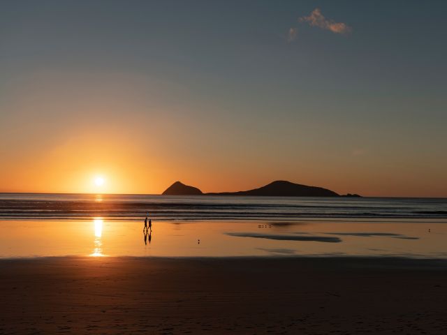
sunset at Wilsons Promontory National Park
Wilsons Promontory National Park is a sprawling wilderness with many coastal bushland trails. (Image: Mark Watson)

Wilsons Promontory National Park (or ‘The Prom’, as you’ll end up calling it) is an easy three-hour drive from Melbourne, but you might ditch the car when you arrive, with much of the park’s 50,000 hectares accessible only by foot. From the inky water of Tidal River (dyed dark purple by abundant tea trees), I like the easy walks along the coast, among lichen-laden granite boulders, to golden beaches and bays.
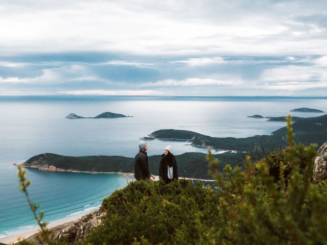
a couple on Mount Oberon
Panoramic views from the summit of Mount Oberon. (Image: Everyday Nicky)

The trail to the panoramic views at the summit of Mount Oberon is a bit harder, up steep timber and granite steps, but it’s a popular 6.8-kilometre return. The more remote hikes are found through the open banksia and stringybark woodland of the park’s north, or along the multi-day Southern Circuit, which ranges from about 35 to 52 kilometres, with sunrises and sunsets, kangaroos and cockatoos, and maybe even whales.

a golden sand beach at Wilsons Promontory National Park
Walk ‘The Prom’s’ golden sand beaches. (Image: Tourism Australia/Time Out Australia)

You might also see whales on the George Bass Coastal Walk, even closer to Melbourne on the western edge of Gippsland. This dramatic seven-kilometre trail along the clifftops takes in sweeping views of the wild ocean, occasionally dipping down from grassy green hills to coastal gullies and a secluded beach. It also now links into the Bass Coast Rail Trail for an extra 14 kilometres.
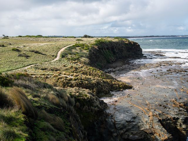
the George Bass Coastal Walk
George Bass Coastal Walk trails for seven kilometres along clifftops. (Image: Visit Victoria/Time Out Australia)

Over at the eastern edge of Gippsland, in Croajingolong National Park, you can wander along the lakeshores beneath koalas and around goannas (I keep my distance since one chased me here!). For those who are even more adventurous, the park is also the starting point for the 100-kilometre Wilderness Coast Walk, usually done over seven days.

the Croajingolong National Park, Gippsland
Wander along the lakeshores in Croajingolong National Park. (Image: Tourism Australia)

Need tips, more detail or itinerary ideas tailored to you? Ask AT.

AI Prompt

The best bush hikes in Gippsland
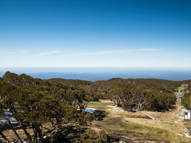
the Baw Baw National Park
The alpine heath of Baw Baw National Park. (Image: Everyday Nicky)

Deep in the Long Tunnel Extended Gold Mine at Walhalla, mining guide Richard tells me how this small town in the mountains east of Melbourne boomed when prospectors found gold here in 1862. These days, you’ll find most of the town’s treasure – its heritage – above ground, with the Walhalla Tramline Walk a wonderful way to explore it.

Just seven kilometres long, the walk takes you through decades of Gold Rush history, following the original rail trail from lush bushland to the mining sites, and through the charming village of just 20 residents with its wooden cottages and old shopfronts adorned with turn-of-the-century advertising posters. Blazing a trail where trailblazers once opened up the region, this is also the starting point for the 650-kilometre Australian Alps Walking Track.

Nearby, Baw Baw National Park has walks through gnarled snow gums and alpine heaths that show off the colourful wildflowers in summer and the pristine carpet of white in winter. Several trails are perfect for snowshoes, including a 45-minute route from St Gwinear up to vast views across the Latrobe Valley.

Further up into the mountains, the Toorongo and Amphitheatre Falls Loop Walk is an easy 2.2-kilometre path that serenades you with the sound of flowing water as you pass mossy rocks and tree ferns en route to two sets of waterfalls cascading over boulders in the remote wilderness.

The best cultural hikes in Gippsland

the Mitchell River National Park, Gippsland
Hike the Mitchell River National Park. (Image: Parks Victoria/Grace Lewis)

Across a pool in a natural sandstone amphitheatre, deep within a cave behind a waterfall, it’s said the Nargun has its lair. A fierce creature, half human and half stone, that abducts children and can’t be harmed by boomerangs or spears, the story of the Nargun has been told around the campfires of the local Gunaikurnai people for generations.

As a culturally significant place for women, hikers are asked not to go into the Den of Nargun, but a 3.4-kilometre loop walk leads you through a rainforest gully to the entrance where you can feel the powerful atmosphere here in Mitchell River National Park, along Victoria’s largest remaining wild and free-flowing waterway.
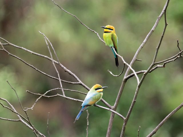
the bee-eaters at Mitchell River National Park
Bee-eaters at Mitchell River National Park. (Image: Parks Victoria/Grace Lewis)

The Den of Nargun is part of the Bataluk Cultural Trail, a series of important traditional Gunaikurnai sites through central Gippsland. Another location is Victoria’s largest cave system, Buchan Caves Reserve, with trails to important archaeological sites of human artefacts up to 18,000 years old. The FJ Wilson Interpreted Walk includes the naturally sculpted white limestone steps of the 400-metre-long Federal Cave, while the Granite Pools Walk goes among tall timber and moss-covered gullies.
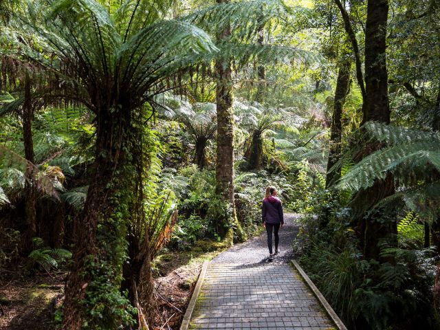
the ancient rainforest of Tarra-Bulga National Park
The ancient rainforest of Tarra-Bulga National Park. (Image: Josie Withers)

Also important to the Gunaikurnai people is Tarra-Bulga National Park, known for its ancient myrtle beeches and enormous mountain ash trees. Just 40 minutes return, the Tarra Valley Rainforest Walk offers a taste of this verdant landscape, while the Grand Strzelecki Track takes you deep into the lost world of forest giants on an epic 100-kilometre trail rich with tradition.

Weekly travel news, experiences
insider tips, offers, and more.

A traveller’s checklist

Staying there
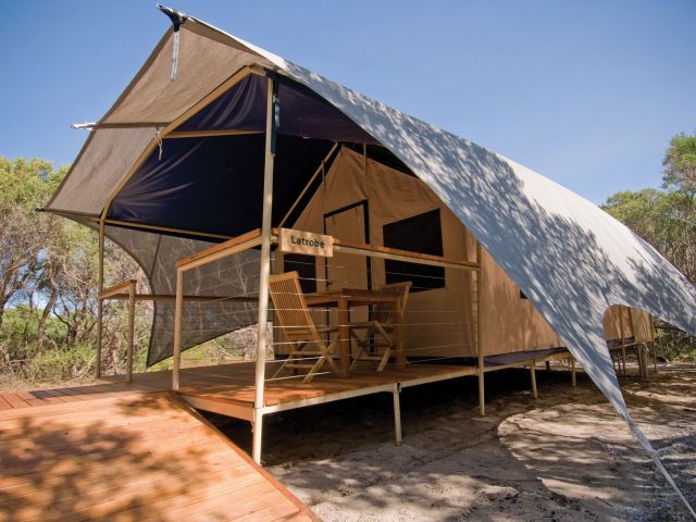
the WildernessRetreats in The Prom
Wilderness Retreats in The Prom. (Image: Christian Pearson)

Wilderness Retreats in Wilsons Promontory offers glamping-style tents with luxurious queen beds. Star Hotel is a reconstruction of a Gold Rush-era hotel from 1863 in the heart of heritage Walhalla. Caves House is a historic three-bedroom house with views over the Buchan River.

Eating there
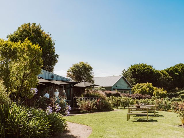
the Carrajung Estate, Gippsland
Enjoy a post-hike lunch at Carrajung Estate. (Image: Everyday Nicky)

Kilcunda General Store serves great coffee and meals of local produce at the George Bass Coastal Walk. Alpine Trout Farm is located near Toorongo Falls in Noojee. Fish for your own lunch and barbecue it with the provided cookware.

Carrajung Estate is a short drive from Tarra-Bulga National Park. The winery’s restaurant offers a seasonal menu of regional ingredients and you can stay at The Lodge.

a seafood feast at Carrajung Estate, Gippsland
The table is set for a seafood feast at the estate.

Video credit: Tourism Australia

Michael Turtle
Michael Turtle left Australia in 2011 to explore the world – and ended up travelling nomadically as a blogger for almost a decade! A little pandemic brought him home, where he rediscovered his love of Australia and all its fascinating stories. Michael is just as happy sipping a shiraz at a vineyard as hiking in the Outback, but his special place is a sunrise walk along Sydney Harbour.
View profile and articles
hero media

The road trips and trails you need to experience in Victoria now

    Kellie Floyd Kellie Floyd
    Wind through fern tunnels, stop for a wine in a tram bar, or chase giant murals across the wheatbelt. These drives and rides prove Victoria’s best stories are found off the straight and narrow. 

    There’s something unmistakably Australian about a road trip: car packed, playlist on, landscapes shifting. Travelling down the highway toward Healesville, in Victoria’s Yarra Valley, the mountains rise, flanking me on both sides. I feel its embrace, a silent invitation to explore what lies beyond.  

    Moss-covered embankments rise on either side, and towering mountain ash trees form a green tunnel overhead. Road signs warn of wombats and cyclists but with giant ferns lining the roadside, the landscape feels prehistoric, as if a dinosaur might suddenly emerge. This, the Black Spur, is one of my favourite road trips. 

    The Black Spur 

    The Black Spur drive
    Through the forested canopy of The Black Spur drive that winds from Healesville to Narbethong. (Image: Neisha Breen)

    Location: Yarra Ranges
    Duration: 30 kilometres / 30 minutes 

    The Black Spur is short compared to other Victorian road trips, just 30 kilometres, stretching from Healesville to Narbethong. But what it lacks in distance, it makes up for in scenery. Just outside Healesville, Maroondah Dam offers bushwalks and scenic views. However, if pressed for time, Selover’s Lookout is an easy roadside stop offering uninterrupted views of the dam.  

    In Narbethong, close to the Marysville’s snowfield, is the Black Spur Inn, a charming double-storey brick hotel that’s been welcoming travellers since 1863. Here, diners cosy up by the roaring fire or gaze through the floor-to-ceiling windows, imagining horse-drawn coaches carrying hopeful gold seekers to the eastern goldfields.   

    Victoria’s Silo Art Trail 

    Silo Art Trail
    The Silo Art Trail in the Wimmera Mallee region. (Image: Visit Victoria/Anne Morely)

    Location: Various towns across the Wimmera Mallee region
    Duration: More than 200 kilometres / 4–5 hours but best over a minimum of three days  

    What began as a way to draw travellers back into town bypassed by highways – places such as Nullawil, Sea Lake and Patchewollock – has grown into a celebrated outdoor art movement. The Silo Art Trail now includes 23 silos, each transformed with large-scale mural portraits sharing local stories, celebrating community heroes, Indigenous history, farming life, or regional identity.  

    The Nullawil silo, for example, is a portrait of a local farmer in a chequered flannelette shirt alongside his loyal kelpie, painted by artist Sam Bates (AKA Smug). And the silos at Albacutya in the Grampians, painted by artist Kitt Bennett, depict her joyful memories of growing up in the countryside. Many of the murals sit right in the heart of small towns, such as Rochester and St Arnaud, making them perfect spots to pause for a country pub meal or something sweet from a local bakery.   

    Metung to Mallacoota  

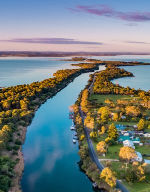
    Gippsland lakes
    Gippsland Lakes. (Image: Visit Victoria/Josie Withers)

    Location: Gippsland
    Duration: Approximately 220 kilometres / 4 hours  

    The Gippsland Lakes are a much-loved holiday spot in Victoria, but road-tripping further east reveals much more. Begin in Metung and time your visit with the monthly farmers’ market, or simply linger over lunch on the lawn of the Metung Hotel. Twenty minutes away is Lakes Entrance, where you can watch the fishing boats return with their catch. 

    Lakes Entrance
    Lakes Entrance. (Image: Visit Victoria/Iluminaire Pictures)

    Continue to Marlo, where the Snowy River spills into the sea, and Cape Conran for its many beaches and walks. If needing to stretch your legs, Croajingolong National Park is home to the historic Point Hicks Lighthouse and the Wilderness Coast Walk. Birdwatching and rainforest trails near Bemm River are worth a pit stop before arriving in Mallacoota, where the forest meets the sea. 

    Great Ocean Road 

    12 Apostles on the Great Ocean Road
    The 12 Apostles on the Great Ocean Road. (Image: Tourism Australia/Two Palms/Harry Pope)

    Location: South-west Victoria, from Torquay to Allansford
    Duration: Approximately 250 kilometres / 4–5 hours but best over a minimum of three days  

    Victoria’s most famous road trip delivers it all: world-class surf breaks, rainforest walks, clifftop lookouts and wildlife encounters. The journey begins in Torquay, the state’s surf capital, then hugs the coast past Anglesea and Lorne to Apollo Bay, before curving inland through the lush rainforest of the Otways. Stop at Cape Otway Lightstation or take to the treetops at Otway Fly.  

    Between Cape Otway and Port Campbell lies the most photographed stretch – seven of the Twelve Apostles still standing, alongside the golden cliffs of Loch Ard Gorge. Further west, Warrnambool is a winter whale-watching hotspot, before the road winds to Port Fairy, a charming fishing village of whalers’ cottages, walking trails and offshore seal colonies further along the coast. 

    Bellarine Taste Trail 

    Terindah Estate
    Terindah Estate. (Image: Visit Victoria/Emily Godfrey)

    Location: Bellarine Peninsula
    Duration: Approximately 80 kilometres / 2–3 hours  

    The Bellarine Taste Trail is a feast for the senses, winding through coastal towns, past boutique wineries and artisan producers. It’s a choose-your-own-adventure style trail – simply grab a map and build your own delicious journey.  

    You might wander historic, seafront Queenscliff, sip wine in a converted tram bar at Terindah Estate, sample a locally distilled whisky at The Whiskery in Drydale or pick up a jar of honey at Wattle Grove in Wallington. Seafood lovers can head to Portarlington, famous for its mussels. Eat them fresh at local restaurants or head out on the water with Portarlington Mussel Tours. 

    O’Keefe Rail Trail – Bendigo to Heathcote 

    Pink Cliffs Reserve
    Pink Cliffs Reserve in Heathcote can be seen on the O’Keefe Rail Trail. (Image: Visit Victoria/Emily Godfrey)

    Location: Central Victoria
    Duration: Approximately 50 kilometres / 4 hours cycling 

    Travellers first journeyed between Heathcote and Bendigo in 1888, when the railway line was built to link the towns. Trains stopped running in 1956, but today the route has a new life as the O’Keefe Rail Trail. The path is mostly level for easy riding, and along the way you’ll cycle past bushland, waterways and reserves. There are plenty of places to picnic, birdwatch, and if you’re lucky, spot a platypus.  

    The trail is well supported with water stations, bike repair points, shelters, and signage. Axedale makes a great halfway stop, with the pretty Campaspe River Reserve for a rest and local cafes for refuelling. Begin in Heathcote, known for its wineries and cafes, or in Bendigo, which is easily reached by train from Melbourne/Naarm. Shorter sections, such as Heathcote to Axedale, are also popular. 

    Goldfields Track – Ballarat to Bendigo 

    Location: Central Victoria
    Duration: Approximately 210 kilometres / 2–3 days cycling  

    The Goldfields Track traces a route once so rich in gold it made Melbourne one of the wealthiest cities in the world. Starting at Mt Buninyong, south of Ballarat, the trail leads mountain cyclists and walkers north through Creswick, Daylesford and Castlemaine before finishing in Bendigo. Along the way, you’ll encounter granite outcrops, eucalypt forests, rolling farmland and remnants of the region’s mining past.  

    As it passes through the lands of the Dja Dja Wurrung and Wadawurrung people, the track shares gold rush history and Indigenous stories brought to life by interpretive signs. Walk or ride the full trail or choose from one of its three distinct sections. With cosy stays, cafes and pubs, it’s easy to mix wilderness with comfort.